Thacker Pass. Photo: Nikki Hill.
“Sagebrush sea” is an endearing term that describes the vast high desert steppe lands of western North America. Rolling hills enveloped in silver green shimmer and sparkle like waves in the mid-day sun. This sea that spans the wide valleys and crests over plateaus connects the peaks and ridges from the shores of the Cascades and Sierra Nevada to the Greater Rocky Mountains. It is vast, indeed like an ocean. Nowhere does it ripple more like a sea than in the Great Basin, which coverrs most of Nevada and half of Utah, held by the Wasatch range to the east and the Sierra Nevada to the West, spilling out into the Mojave to the south and well into eastern Oregon in the north.
Many of the desert plants do indeed resemble ocean creatures: coral-like cactus and urchin-like succulents. Although it is commonly thought of as desolate and emptiness, the high desert steppe is incredibly abundant and alive. 350 species of wildlife and insects depend just on sagebrush herself.
The sagebrush sea is one of the largest continuous landscape types in North America, but only 5% of the area receives protection at the federal level, making it the least protected landscape in the USA.
This sea has been speaking to me for some time now. Calling me back, holding my attention, inviting me to see the patterns within it. In 2009, I was first introduced to the various First Food plants of the high desert, the traditional staple-food plants, and the reciprocal relationships that have fostered them for thousands of years. I have dedicated the majority of my time to following these plants since 2013, spending time camping and interacting with them, learning how to tend them, gathering and planting their seeds and picking up their stories as I wander. I have become endeared to them, bonded to their continuance in heart and hand.
There is so much in the sagebrush sea, so many plants with lineages enmeshed with the Indigenous Tribes who traditionally tended them. The ecology of the high desert steppe exist in part due to the intentional cultivation of these plants to create future abundance. Cultivation was accomplished not with a plow but with a keen understanding of what the plants needed and with intentional choices when gathering and planting. The plants themselves have evolved under the influence of their interactions with humans. Many of the starchy roots are encouraged by the beneficial disturbance of digging them, an the action that leaves cracks in the soil for seeds to germinate in. These First Food plants have evolved to be prolific in the mosaic of seasonal gathering areas, in “wild gardens” that were tended for many generations before European colonization.
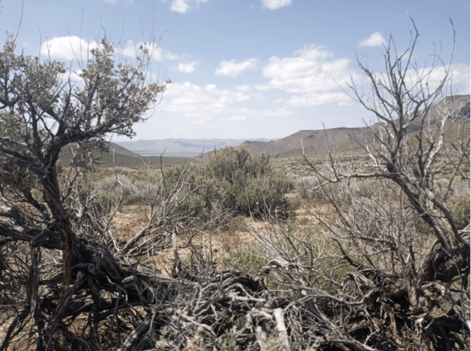
In 2021, I heard that a lithium mine was being proposed within this sea, in a region where I had been told the wild gardens were still largely intact. Pee hee Mu’huh, also known as Thacker pass, exists in the northeast region of Northern Nevada, close the Oregon border. It is and has been a corridor of travel and migration for many beings, and is part of the homelands of Paiute, Shoshone and Bannock people. It is a sacred burial site where there have been two known massacres and holds 1,000 cultural sites. There has been an ongoing resistance campaign since January 2021 to stop Lithium Nevada Corporation from moving forward with their plans to destroy this place with a 17,933 acre open pit mine. I have visited seven times in the past year to offer my support and to just spend time there.
I am interested in showing how the plants on the landscape could be considered physical evidence of human habitation and history: a living, botanical archaeology. Not all of the traces of ancestral Indigenous presence were made of stone and bone: these wild gardens—a collaboration of humans, plants and place—also tell the story of thousands of years of lineage.
This spring, I ventured out to visit Pee hee Mu’huh with a particular focus: to do a survey of the First Food plants there. My intention was to track the patterns of their presence, and to describe the human relationship in those patterns that can still be seen there. The method was to just start following the plants when they appeared and see where they led me. I took photos and GPS points to map what I was being shown on my walk, so that someone else could follow my path and corroborate what I was seeing.
The following is a summary of my time spent surveying the rolling sagebrush and rocky hilltops of Peehee Mu’huh. My hope is that the presence of these plants can come to be understood as archaeological evidence of long-standing relationship in the high desert lands, and that they be granted the right to continue existing as the living legacy they are.
* * *
First Foods Survey Summary for Peehee Mu’huh (Thacker Pass): April 2022
Understanding the ecology and history of a place requires observations at various scales, from landscape level down to individual plants. A pass, such as Peehee Mu’huh, is a way through, a corridor of movement and migration. Both in the short term—such as seasonally—and in the long term—over millennia as species advance and retreat with the coming and going of ice ages. A pass is a channel through which relationships flow.
The signs of many past relationships can still be seen at Peehee Mu’huh. The patterns of patches of Native American first foods in the area are a living archaeology there, as they are in many other places. Their presence maps a layer of relationship to a landscape: these are plants that have been tended and cultivated for thousands of years in a reciprocal relationship of sustenance as the heart of a traditional lifeway. Many of these plants thrived in response to the human scale disturbances associated with procuring them. The act of harvesting intentionally encouraged the abundance of these food plants around winter camps, along migratory trails, and among rocky areas that were regularly visited. Cultivation was collaborative in this sense, involving humans, animals and the plants themselves, with their specific proclivities, in a seasonal flow following the shapes of the landscape. This kinship with place created a horticulture based in endearment.
The present plant communities at Thacker Pass outline a picture of various layers of relationship and past disturbances. There are the layers of migration: hunting, gathering and traveling; the layer of ranching: boxed springs, pastures and compacted soils; and the layer of wildfire: regenerating sagebrush, charcoal soil deposits, missing pinyon and juniper, and recovering first food plants.
The introduction of mining would preclude all other relationships, a use beyond all others, one that will erase the threads of history.
The structure of this survey was to follow the presence of a few first foods: the biscuitroots (Lomatium and Cymopterus spp.), Yampa (Perideridia spp.), the lilies (Calacorthus, Fritillaria and Camassia spp.), the wild onions (Allium spp.), wild greens (Phacelia spp.) and bitterroots (Lewisia spp.).
Here I offer what I observed. Many of these glimpses would benefit from corroboration with others, who may or may not see the same patterns, and may have other observations and understandings.
I began walking up ephemeral water flow drainages from the middle of the valley, along Kings valley road, towards the Montana mountains. I walked along five main drainages, and various smaller ones (slight depression tributaries). Yampa, Perideridia bolanderii, appeared along every drainage I walked, along their entirety, every two to ten steps.
The drainages become much shallower as one walks towards the Montana mountains. Yampa and the bright green of the scattered grasses continue in these areas, all the way to the base of the steep slopes.
Yampa has a nutty carrot flavored root that has been cultivated by humans in high desert niches that can support them. These niches include flat hilltop dry meadows, shallow drainages along hillsides, and riparian areas: places where water lingers slightly longer in the springtime. Yampa is found further up the banks of these drainages, and scattered throughout the surrounding sagebrush, in spots where mounds from digging, from burrowing animals and past human activities, had occurred.
Surveying the slopes above lower drainages, where the slopes were steeper, illuminated a pattern of scattered, cracked and eroded mounds that consistently supported other first food plants: Mariposa lilies (Calochorthus spp.) and Biscuit roots (Lomatium spp.).Relative to surrounding areas, these plants appeared on or adjacent to the eroded mounds. There is a reciprocal relationship to digging that can be observed here
The act of digging, and the cracking of the soft soils from those soils drying out, creates places favorable germination. Densities are concentrated where camps have been made in the past and scattered along travel routes.
It has been my experience that densities of these food plants increase relative to areas of past human interaction: wild gardens resulting from intentional cultivation that weave together populations of these plants across the entire Western region of the United States.
Mariposa lilies and biscuit root species are found scattered throughout the sagebrush and rabbitbrush areas of Pee hee Mu’huh. There are a few landscape indicators where they become more relatively dense. These include eroded and cracked mounds from previous digging, in spaces between larger shrubs where soil crusts remain and on rolling hilltops with shallow rocky soils. Lomatium, Calocorthus and Allium species occur in these areas. Companion plants that are indicators for first food plant gardens include short sagebrush (Artemisia arbuscula), Phlox caespitos, Townsendia spp. and Lupinus nevadenses.
There are areas where the rocks appear puzzled together into rock flows on the landscape. These areas occur on rolling hilltops along the valley and continue up on higher mountaintops. These are where to find collections of the first food plants. Many of these areas were in fact intentionally created to hold more water and make harvesting easier for food plants. Others are the result of generations of digging and relation to topography (shallower soils on hilltops expose more rocks).
The powerlines that run parallel to the Kings valley highway follow some of these rocky topped rolling hills. To the West side of the main access road and the ceremonial camp, there are well-defined rock flows on rolling hilltops that support very dense populations of wild onions (Allium spp.). These rock flow areas, and the presence of the onions, are indicators for the presence of other first foods, such as mariposa lilies and biscuitroots.
There are well defined examples of these rock flow areas that were intentionally created to make harvesting the deep tap roots (reaching up to 3’ deep) of biscuitroot species easier throughout the West. The known places I was shown are in NE Oregon in Nez Perce territory, and in SE Oregon in Klamath territory. The rocks appear puzzled together in flows that meander around small hills of soft, rock free soil. The rocks were placed together in two layers, and seeds sown into the cracks. When the biscuit roots begin to grow downward, they hit the lower rocks and begin to grow sideways instead of straight downwards. When mature plants are harvested, the top layer of rocks can simply be lifted up, and the roots gathered up like loaves of bread from the desert with minimal digging necessary. The relationship of the hills to the subtly sunken rock flows provides a moisture collecting niche capable of supporting this localized abundance of first foods as well. This style of horticulture arose from generations of intentional cultivation with the focus of continued abundance for future generations. This layer of relationship, this pattern of small hills and rock flows in the landscape, can be followed thru Paiute and Shoshone lands of Nevada and into the Ute and Ouray lands of Colorado. The abundance of first foods in these landscape niches depends on the recent history of accessibility for engagement in traditional tribal tending practices. However, the thread of that intentional relationship can be seen in the patterns of microtopography that remain.
On steeper inclines just below mountain ridgelines, various rocky scree areas are in abundance. These areas also are an indicator for greater densities of first foods and medicines, such as Lomatium dissectum. A Mcdermitt Paiute elder shared with me that people would often plant in these areas, because the rocks held moisture a bit longer than other areas. The upper slopes of the Montana mountains are covered in these scree areas.
The pattern of first food densities in rock flow areas continues up on the mountain tops. Here, different biscuit roots and indicator companion plants reside: Lomatium vaginatum, Hydrophyllum capitatum (Woollen breeches, providing wild greens and edible rhizomes) and Viola beckwithii (indicator plant for higher elevation rock flow garden areas).
At the eastern edge of the proposed Thacker Pass site, there is a deep ravine bound by tall rock spires. Along the ridgeline created by these spires, shallow rocky soils support the presence of bitterroots (Lewisia spp.). These are traditionally tended plants as well, gathered for their somewhat bitter, starchy roots for use as food and medicine. They have a fondness for high peak areas along gentle shelves. Being a succulent type of plant, they can reproduce whole new plants vegetatively from small pieces of roots or leaves. The act of digging serves to increase their abundance when done with this in mind.
As mentioned earlier here, there are other layers of relationship at Peehee Mu’huh. Purple musk mustard (Chorispora tenella) outlines cattle pasture areas and is flanked by other mustard family species. Mustards are a common indicator for softer soils that have become compacted and low in fertility from different land use activities: think pastures (previously tilled or not), abandoned homestead sites and areas of intense soil disruption. These plants show the footprint of this type of disturbance, representing a stage in plant community succession relative to present conditions. Other plant communities have been and will be expressed depending on time and future disturbances or lack thereof. This footprint appears at Peehee Mu’huh around boxed springs that created watering holes and naturally moist depressions: places where grasses flourish from the water and cattle spend time grazing and hydrating. It also appears around test digging sites for lithium extraction at the Thacker pass site.
Previous wildfire is expressed at the foot of the mountains as annual grasses and regenerating rabbitbrush along the bulldozed fire break. Just below the edge of this fire break, along the inside edge of the proposed project site, the next generation of younger Lomatium macrocarpum biscuitroots are growing amongst the skeletons of their grandmothers: look for the rolling hilltops that still hold the faint traces of rock flows, a reminder of potential tending that sustains mutual existence. All of these layers overlap, the plant communities expressing the interplay of these relationships.
One could, (as I did), walk up water flow drainages, across sagebrush flats, scale the mountainsides, wander the mountaintops, descend ridgelines back towards the rolling hills of the valley bottom and find the patterns of first food plants the whole way. These patterns exist because of a relationship to the place: the long tended reciprocal endearment to these first foods.
It is my view that the presence of common first food plants is grounds for representation of a living legacy of tended history: that to destroy these lands is to destroy the living archaeology of the place. The foundation for this concept requires considering the mutual collaboration necessary for continuance: the people need the plants, and the plants need the people, and this reciprocal relationship weaves into the fabric of the regional ecology.
For more info:
Basin & Range Watch Joins Group Lawsuit Challenging Destructive Thacker Pass Lithium Mine
People of Red Mountain – About us
Activists Occupy Site of Proposed Lithium Mine in Nevada (Counterpunch)