In late July and early August, 2026, the Bitterroot National Forest (BNF) once again used a small fire burning far back in the wildlands to justify a lawless logging project miles from the fire. Despite orders from the USFS Chief and USDA Secretary of Agriculture to use a full suppression strategy on all wildfires, BNF chose to suspend direct suppression activities a few days after the fire started and instead built miles of indirect fire lines 3 to 5 miles away from the fire. These fire lines conveniently removed a large amount of commercial timber, including old growth and also timber from a Research Natural Area where “timber harvest is not allowed” (BNF Plan).
The North Fork fire was started by lightning and reported on July 24, 2026, at ¼ acre. It was burning on a steep, rocky south-facing slope with little vegetation at the 8,000-foot elevation, near timberline, and almost 6 miles from the nearest private land. By the next afternoon, it was sized at 15 acres, then 40 acres on the morning of July 26. Helicopters dropped water on the fire on the 24th and 25th, and then, curiously, had stopped by the 26th. By July 27th, the fire was mapped at 105 acres, including outlying hotspots, and was showing minimal growth, according to BNF posts.
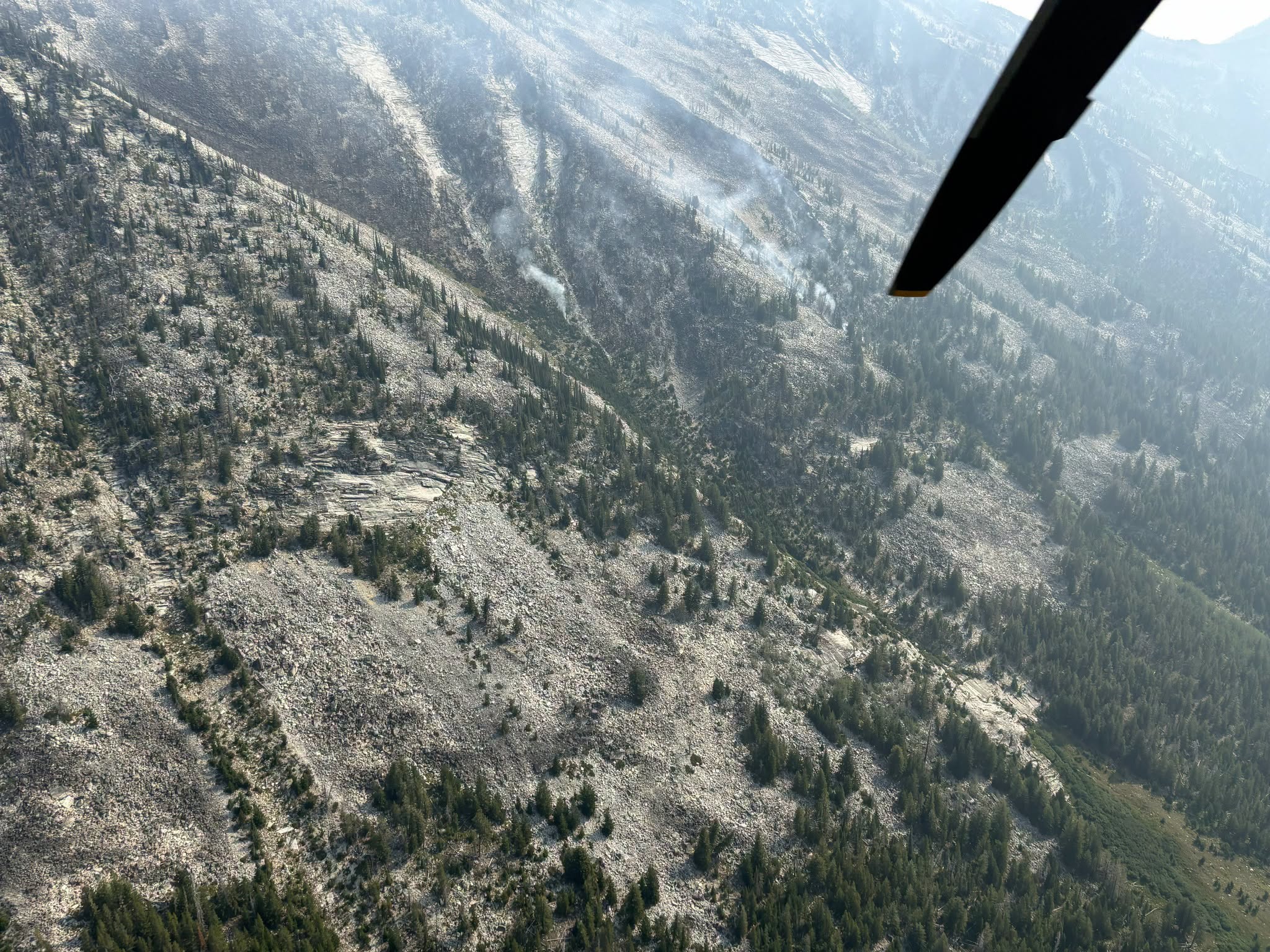
Above is a July 27th view of the fire when it was mapped at 105 acres. Smoke issuing from hotspots is visible left of the wing tip. BNF Facebook photo.
Perhaps direct attack was suspended because heavy equipment arrived on the 27th to begin constructing “indirect” fire lines from 2.5 to 5 miles from the fire. The full suppression policy to “use all available resources to extinguish a wildfire” and to “accelerate initial attack and use a full suppression strategy…. to suppress fires early and limit growth” had apparently been abandoned, and a let-it-burn strategy was emplaced. No more water drops occurred after the 26th and fire fighters were never sent in to the actual fire. BNF posted that “inserting firefighters at this fire’s edge poses several safety concerns due to steep and rocky terrain and no evacuation routes”. They also later posted that they were not doing water drops because it might make burning debris unstable and cause it to roll downhill.
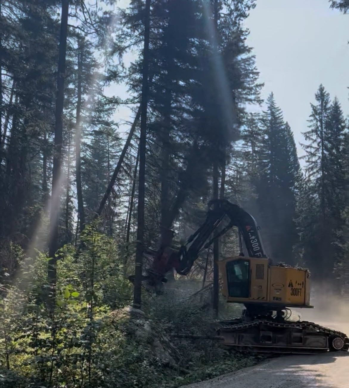
“Heavy equipment” included lots of logging equipment like this feller-buncher working along the Lost Horse Road fire line. The majority of fire suppression activities appeared to be of this type. This BNF Facebook photo also shows the shady, cool character of the road surrounded by old growth forest.
Wildfires in 2016 had resulted in the construction of many miles of indirect, or contingency, fire lines in the area that could have been easily rehabilitated for this fire by simply brushing them out, but they contained little commercial timber. Instead BNF constructed brand new “shaded fuel breaks” that resulted in huge log decks. We will not know the timber volume until sales are advertised later this year, but this was an obvious attempt to meet timber targets by declaring an emergency so that NEPA could be ignored and fire money could be used.
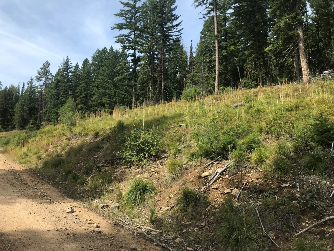
View of one of the existing 2016 fuel breaks along a road near the newly constructed fuel break. Even though it would have made sense to rehabilitate these old fire lines for the North Fork fire, BNF did not. Was this because it would have resulted in few logs on trucks?
Two brand-new indirect lines were constructed: a 1.7-mile-long one on a ridgeline 4-6 miles southeast of the fire and a 7-mile-long one along the Lost Horse Road (see satellite view below). While both cut mature timber that was piled in log decks to be sold later, the Lost Horse Road logging resulted in an enormous amount of timber. Lost Horse Road is the only road into the heart of the Bitterroot Mountains, and its surroundings are (or were) reminiscent of a national park. It is highly valued for both its mountain views and for its passage through a shady, old growth forest. BNF has long tried to log here but was never successful due to fierce public opposition and NEPA. Most recently, BNF tried to get the Lost Horse Road included in the WUI to make it easier to justify logging there, but not even the pro-logging county commission allowed that. Now, by declaring a fake emergency, BNF was finally able to get some of those logs.
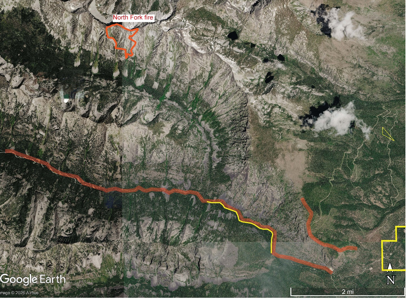
View of newly constructed fire lines in red in relation to the North Fork fire near top of photo. Note 1) the large amount of rock and treeless, rugged topography, 2) the map scale in lower right, 3) the distance (almost 6 miles) to private land with structures (yellow polygon in lower right corner is BNF boundary, private land is to the east). It’s hard to imagine these houses being threatened by this fire, or being protected by these fire lines that are parallel to the prevailing west winds. In the future, these fire lines are likely to increase wind speeds, dry fuels out, and increase, not decrease, wildfire hazard. The long fire line at the bottom of photo extends for 7 miles along the Lost Horse Road. It appears that they harvested timber wherever there were mature trees on flat ground accessible to a feller-buncher or harvester. Where the trees were small or the terrain was steep, no work was done, so the fuel break is discontinuous and varies in width from the width of the existing road to over 200 feet. The road and fire line bisect a Research Natural Area (RNA), shown above where a yellow line parallels the red fire line. “Timber harvest is not allowed in RNAs” according to the BNF Plan. This fuel break follows Lost Horse Creek, which was proposed by BNF Plan for inclusion in the Wild and Scenic Rivers system and is designated Critical Bull Trout Habitat.
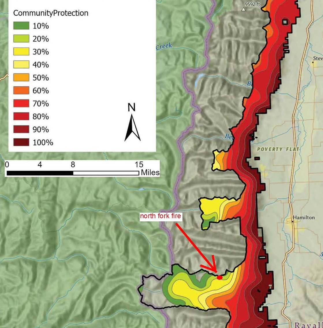
BNF’s own fire models showed the North Fork fire as having only a 20% chance of spreading to private land (from the Bitterroot Front Final EA, p.6).
Despite two “critical fire weather” events with strong winds and high temperatures, the North Fork fire did not grow after August 4th, with acreage peaking at 118 acres. Nonetheless, personnel assigned to the fire, probably mostly private contractors, peaked at 166 August 10-11th, long after fire growth had stopped. August 13-15 brought measurable rain, and by August 19th, drone flights detected no hot spots—the fire was out thanks to mother nature. On August 19th, the final fire update, there were still 94 people assigned.
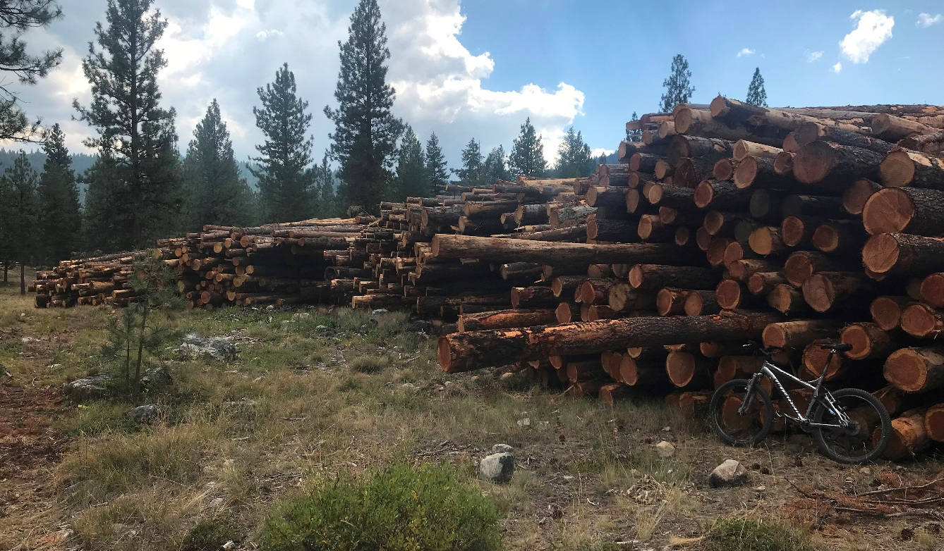
One of the log decks derived from the Lost Horse Road fuel break. Bicycle for scale lower right.
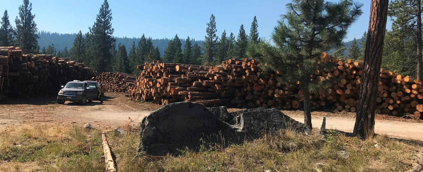
Log decks derived from the Lost Horse Road fuel break. The oldest trees we found in our quick look, by species, were ponderosa pine, 325 years, Doug fir, 212 years, and spruce, 128 years, but there may have been older trees cut. There were also 3 smaller log decks in the area of the northeastern fire line along the ridge. The volume of timber was estimated at 400,000 board feet by District Ranger Brown, who stated this was only 1/10th the size of a typical timber sale (Missoula Current 9-22-2026). Maybe it was small, but it sure was easy, with no NEPA, no environmental analysis, and no public process. It sold in October, 2026, for $66,000.
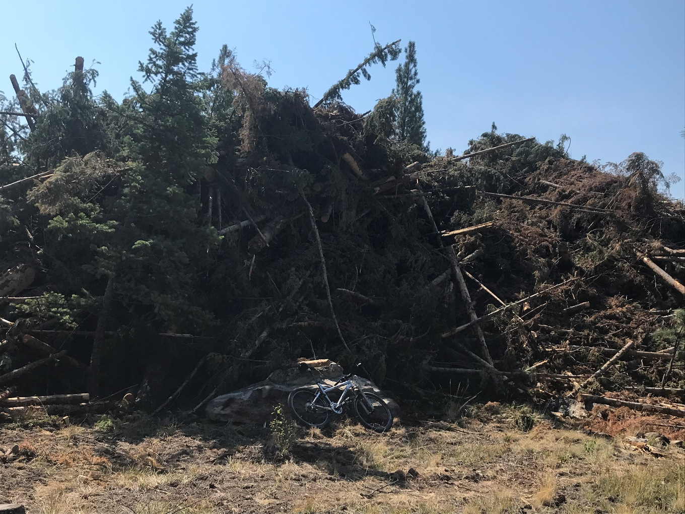
The above photo shows enormous slash pile resulting from the Lost Horse fuel break. This will probably be burned this fall or winter, adding tons of carbon to the atmosphere. Note bicycle for scale.
Pictures below examine the 7-mile long Lost Horse fuel break, which runs along the Lost Horse Road that follows Lost Horse Creek, which was proposed in the BNF Plan for classification as a Scenic River under the Wild and Scenic River System and is designated Critical Bull Trout Habitat.
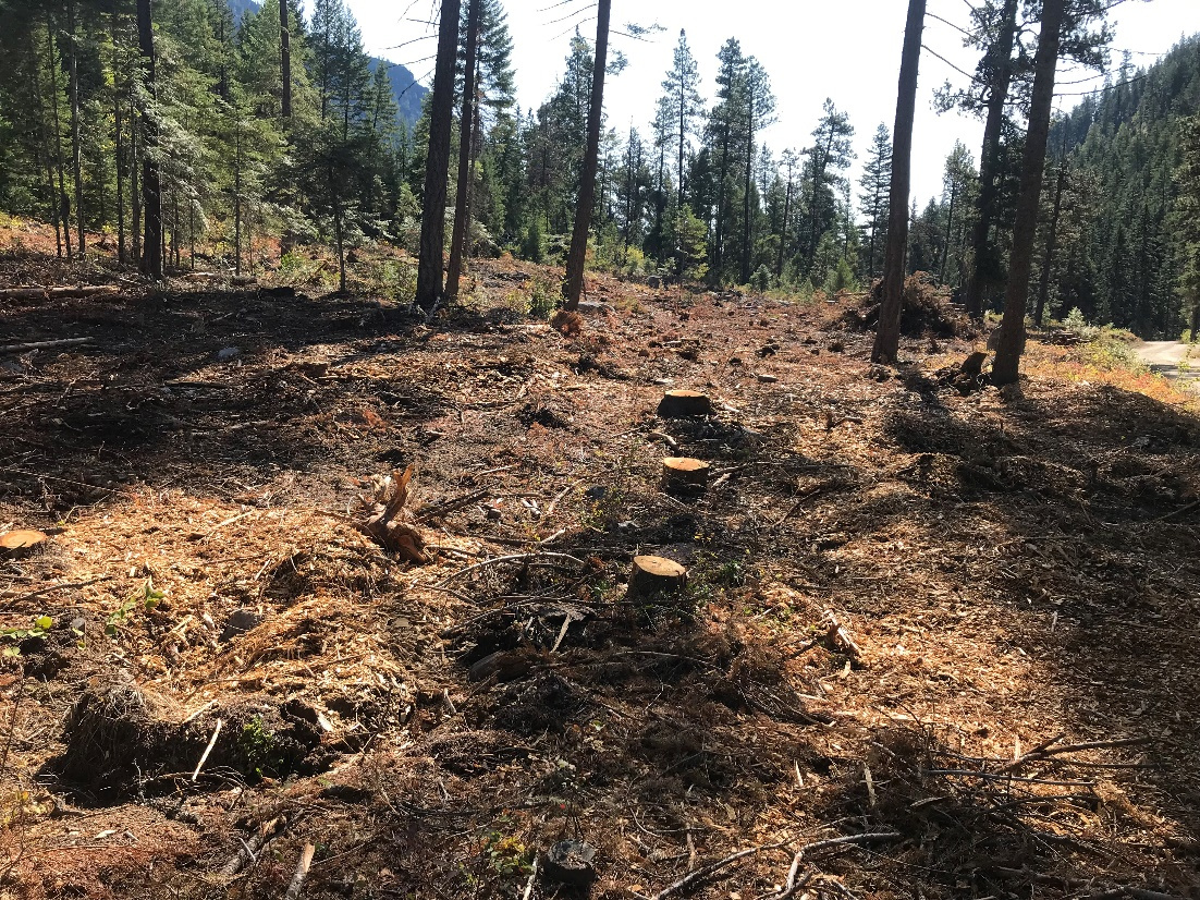
Eastward view of the Lost Horse Road “shaded fuel break” within the RNA, where “timber harvest is not allowed”. Note the slash pile and abundant “ladder fuels” remaining (background and upper left).
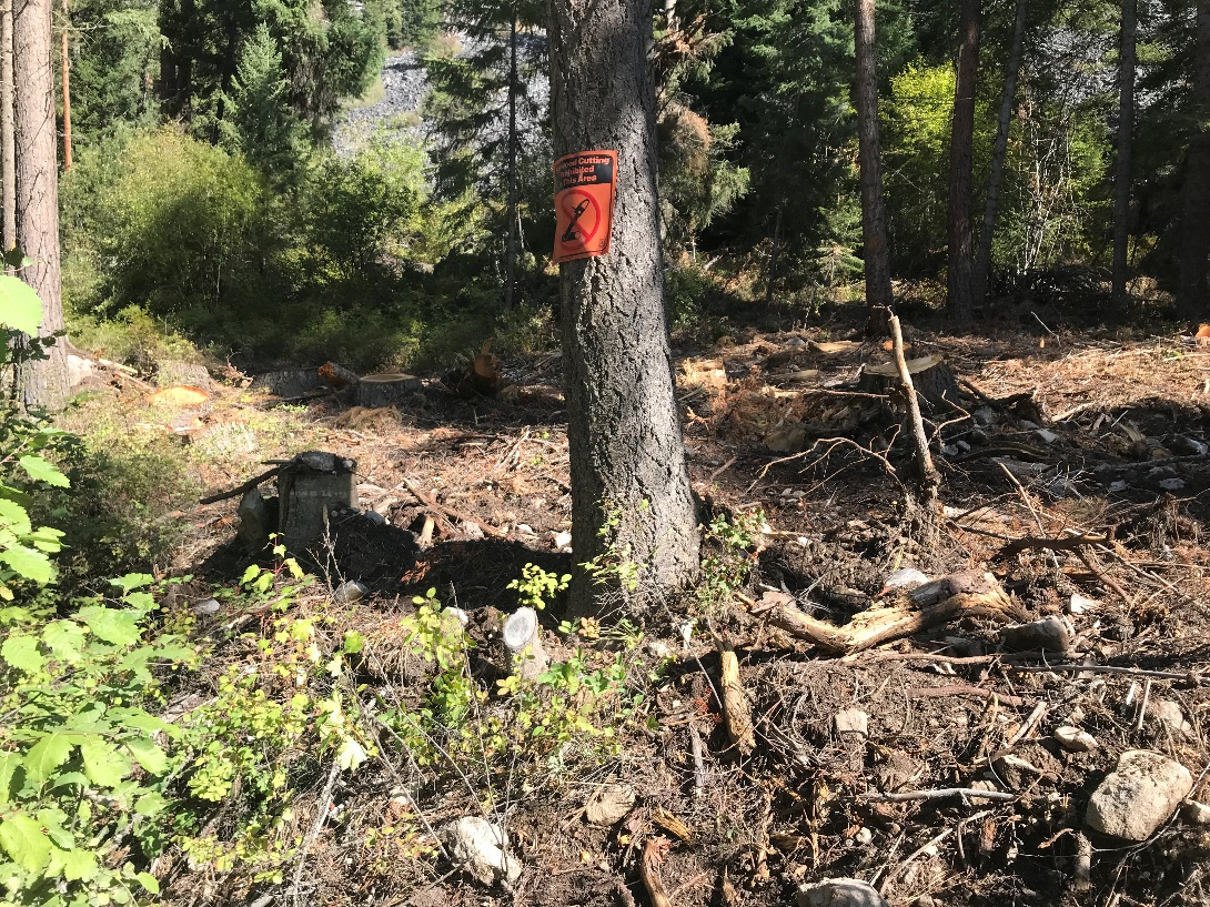
Sign along the RNA boundary reads “Firewood cutting prohibited in this area”. Not even firewood cutting is permitted, but there are 9 stumps behind the sign where Doug firs were cut and removed for the fuel break. BNF later removed this incriminating sign.
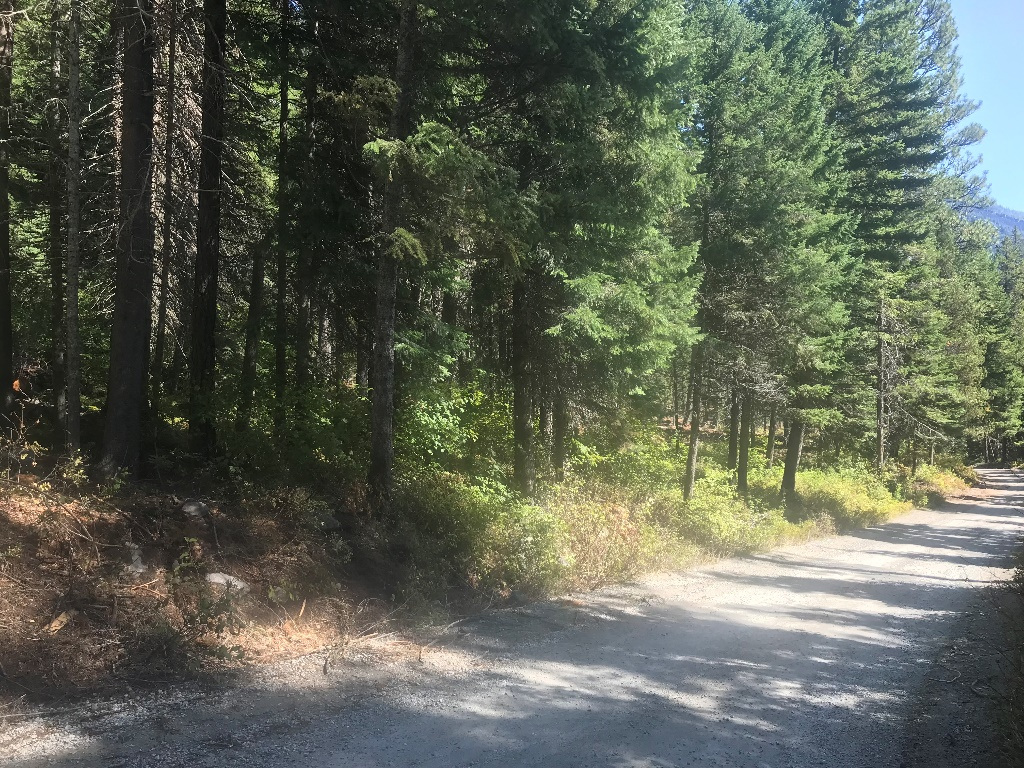
Where the trees were small and unmarketable, BNF left gaps in the fuel break. Note stumps in lower left where there were bigger, marketable trees to be had. Eastward view of Lost Horse fuel break.
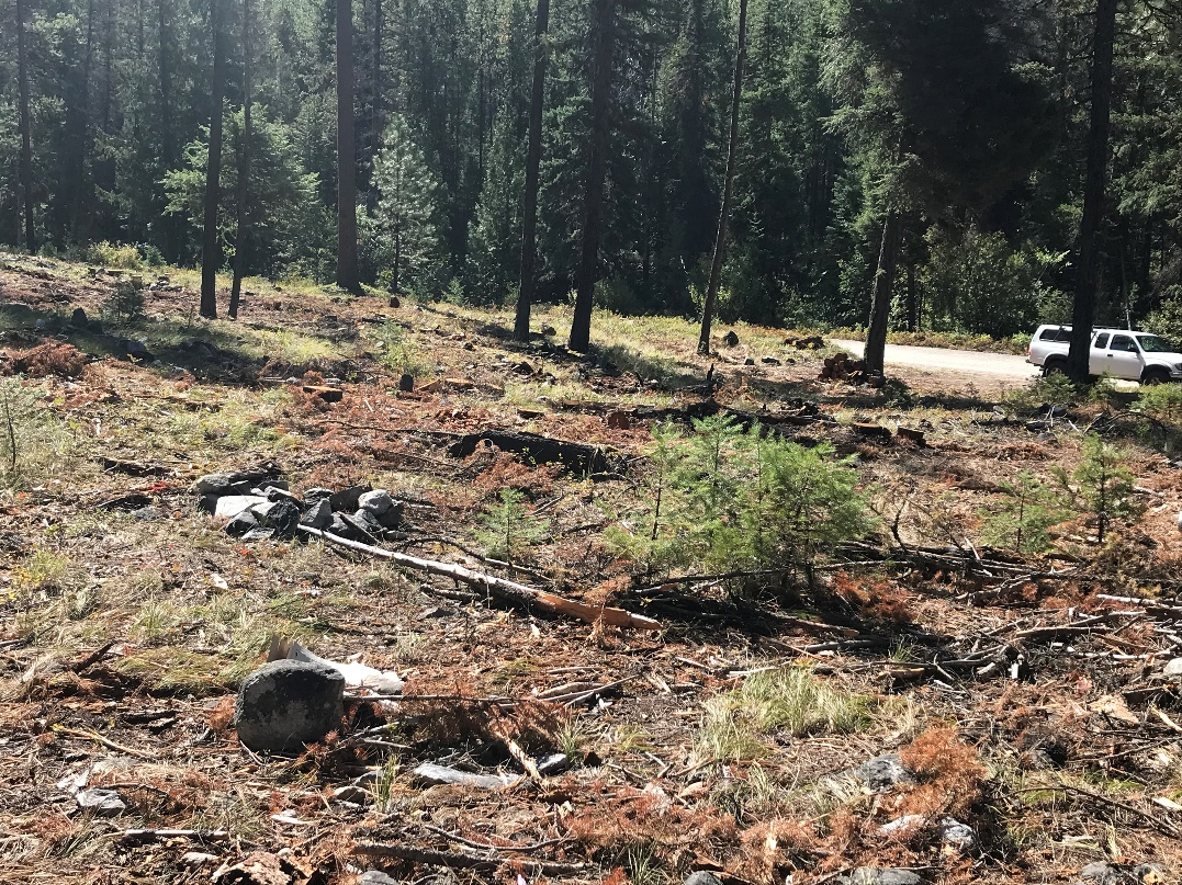
Many shady dispersed campsites were degraded (see old fire ring left of center). This had also been a popular huckleberry picking area. It will probably be many years before the huckleberries recover and many more before shady campsites return.
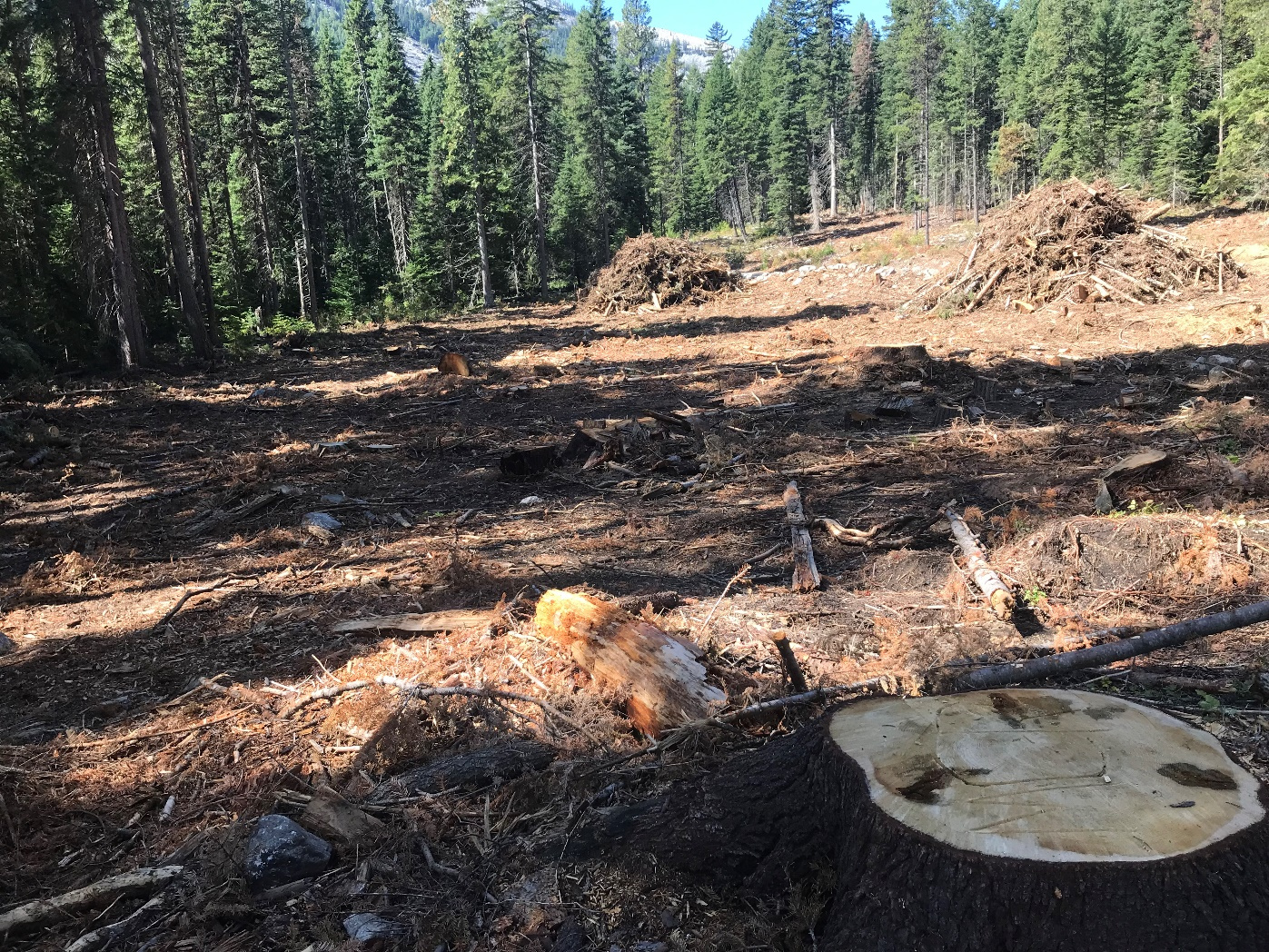 .
In one area, a wet riparian area was cut on the south side of the road near Lost Horse Creek. They did honor the 150’ INFISH buffer so that nothing is illegal; it’s just an ecological crime. Lost Horse Creek was proposed for inclusion in the Wild and Scenic Rivers system in BNF Plan, and is also declared Critical Bull Trout Habitat. Trees cut here were more than 4 feet in diameter at the stump, and the fuel break is on both sides of the road and is 200 feet wide. Why were large slash piles left inside this “fuel break”? Westward view with road on upper right. Lost Horse Creek is 150 feet to left of the clear cut. District Ranger Brown stated this logging was a mistake by the contractor (Missoula Current 9-22-2026).
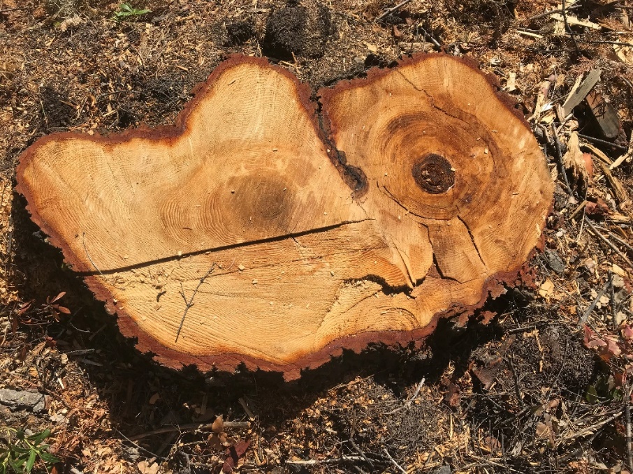
Above harvested Doug fir was 181 years old and would have qualified as old growth, defined by BNF as over 170 years old and 21 inches in diameter at breast height. Many stumps disputed District Ranger Brown’s claim (Missoula Current 9-22-2026) that the old trees in the log decks had already blown down in a December 2025 windstorm.
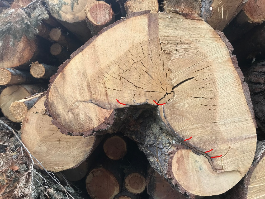
This 200-year-old ponderosa pine in the Lost Horse log deck appeared to contain at least 3 previous fire scars shown by red lines, the most recent one about 75 years ago. It’s ironic that it stood through at least 3 previous fires but was felled by the North Fork fire that never even got close to it.
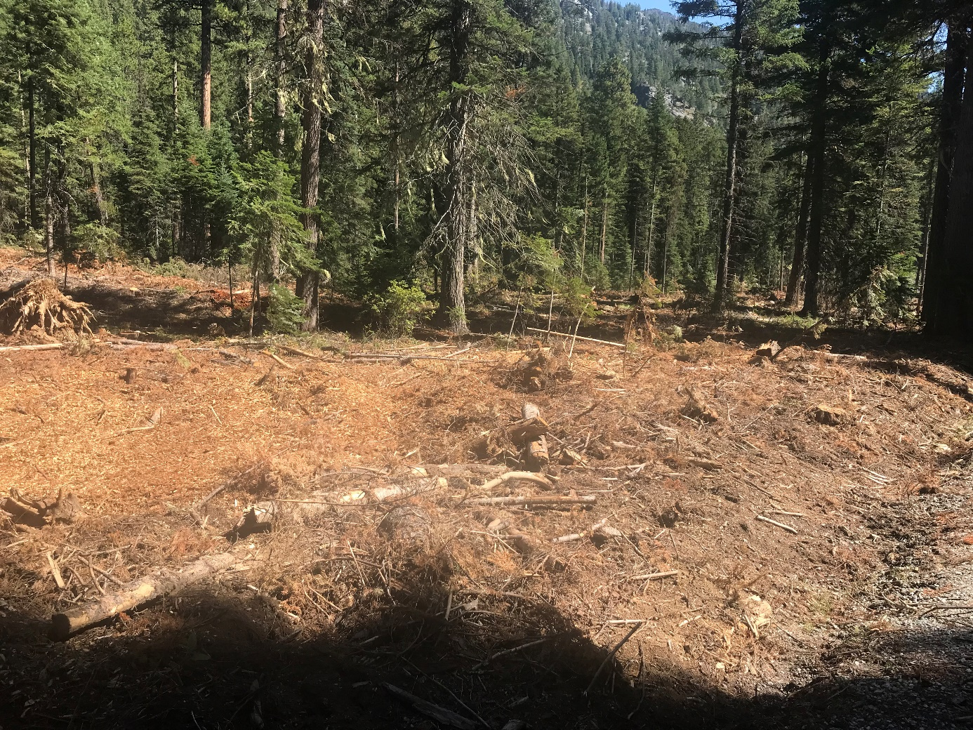
Fuel break here is 2.9 miles southwest and upwind of the fire, and separated from it by a deep valley and a 3.000-foot-high, above-timberline ridge. It is over 7.5 miles from the nearest houses. Note small ladder fuels remaining. Eastward view with road in lower right corner.
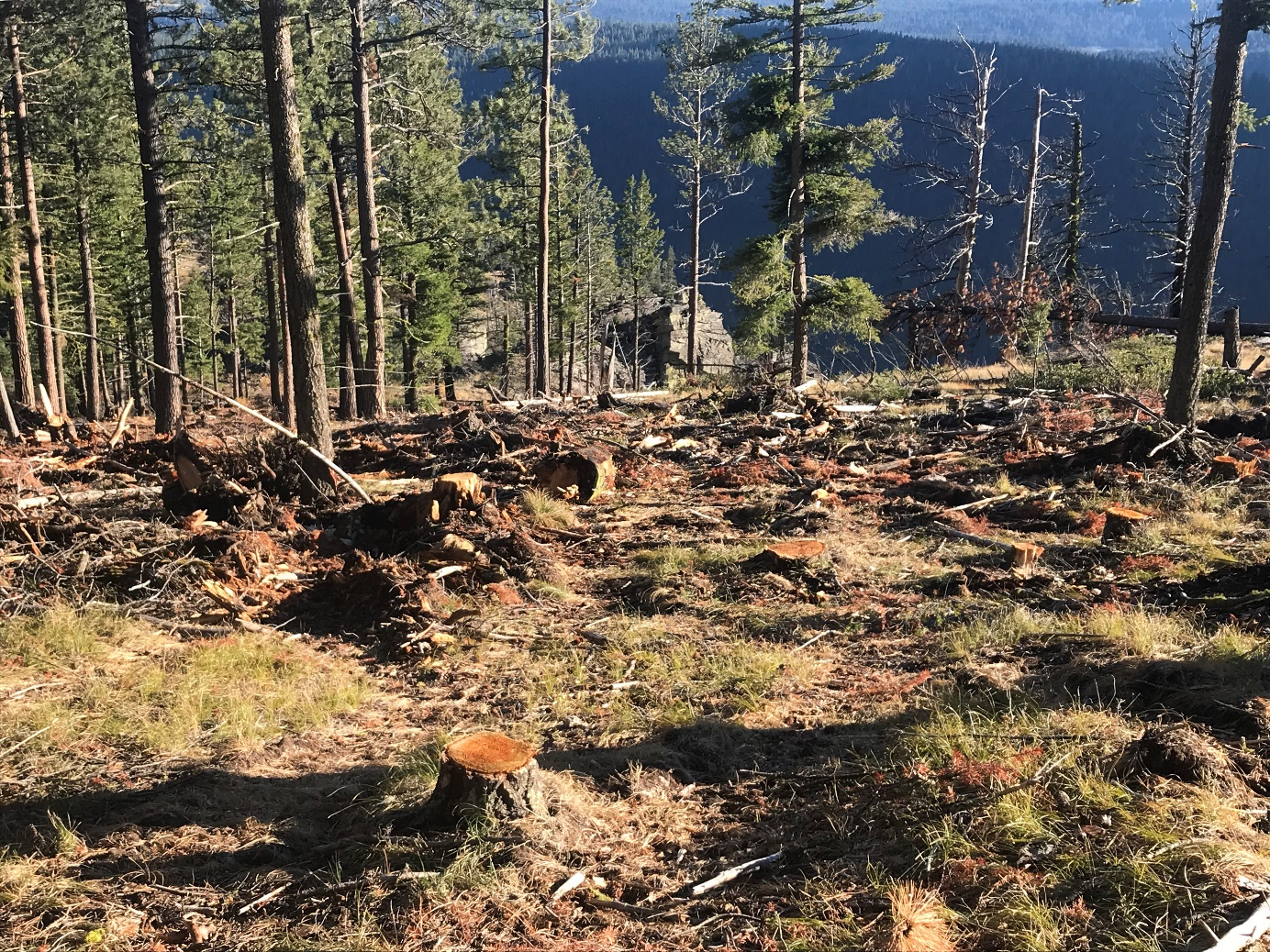
Photo from the northeastern, ridgeline fire line (see previous Google Earth image for location). The fuel break was 100 feet wide in timbered areas, but here the only fuels removed were the green mature Douglas firs—note the scattered stumps. Dead and downed woody debris, fine surface fuels, and slash were all left behind, and it’s unlikely that this fuel break would stop or slow a fire.
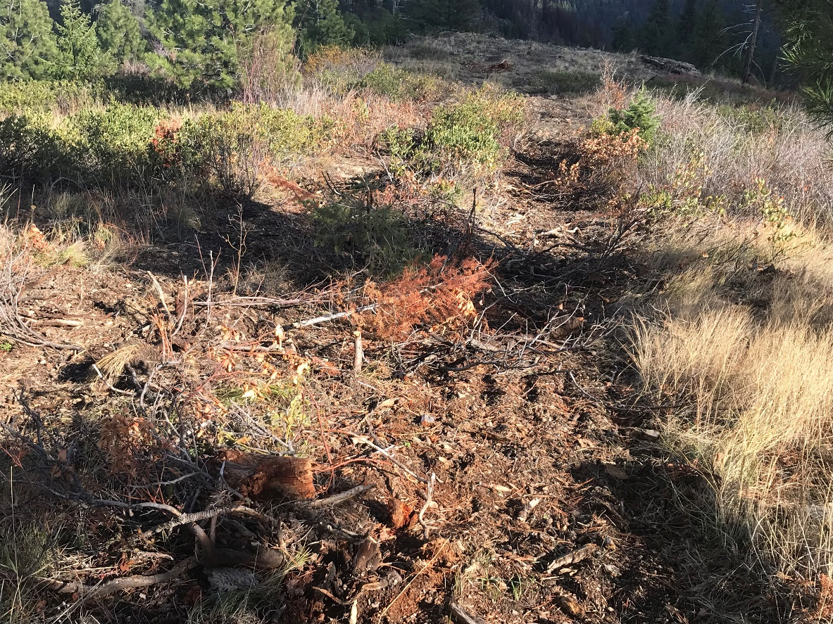
In areas without trees on the northeastern fire line, the fuel break only consisted of the feller-buncher tracks. Fuels, in this case fine surface fuels, were not addressed.
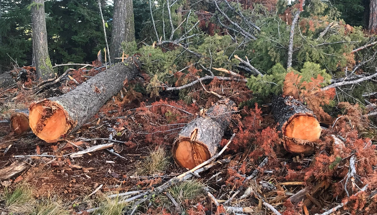
Along the most remote part of the northeastern fire line, more than 25 mature Doug firs were cut and left. Some were over 100 years old. Did the contract specify that all marketable trees were to be transported to the log decks? These were probably left behind by the contractor in order to save the high cost of transporting them to the landings.
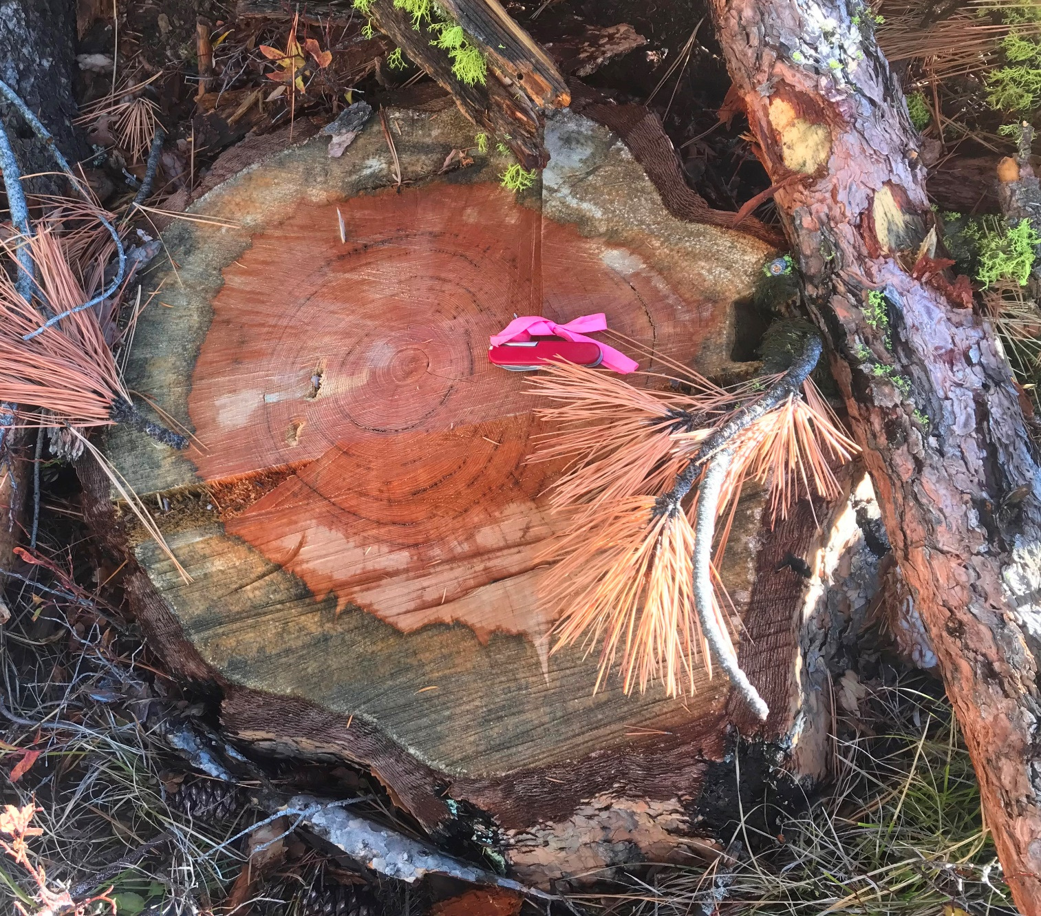
Among the trees cut and left behind on the northeastern fire line were two 300-year-old ponderosa pines. This stump had 325 annual rings and was about 24 inches in diameter. The other old ponderosa was of similar size and probably also over 300 years old. Both still had green needles and both had been standing, conflicting with District Ranger Brown’s statement in the Missoula Current (9-22-2026) that all the old growth they cut had already been blown down in the December 2025 windstorm.
What was the cost to the taxpayer to “suppress” the North Fork fire? We’ve heard unofficial estimates of $3 million to $5 million. In October, 2026, BNF sold all the log decks generated by the North Fork fire work for $66,000, resulting in a very poor return on the taxpayers’ investment. If nothing else, the public should be outraged that this amount of money was spent on a small fire that posed no immediate threat to the communities located almost 6 miles away.
BNF has used fake fire emergencies like this one to do other lawless logging projects. In 2022, they logged a 129-acre rectangle at the Mill Creek trailhead whose area coincided with a previously proposed logging project that was shut down during the NEPA process. They justified the emergency logging using a fire burning 7 miles away, deep in the Selway-Bitterroot Wilderness. A few days after the logging began, a weeks-long rainy period started and put the fire out, but it did not stop the logging. They called the logged area a “shaded fuel break”, but it was a funny shape for a fire line and took many of the biggest, most fire-resistant trees.
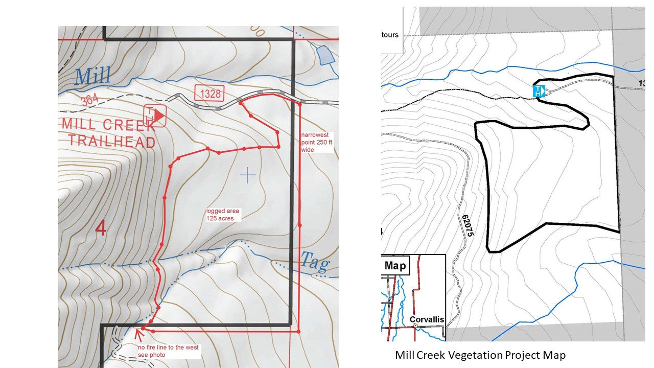
The above maps compare the Mill Creek Vegetation Project proposed in 2014 (right) with the 2022 logging project disguised as fire suppression (left, outlined by red line). The Mill Creek project was scoped in 2014 but then dropped because extraordinary circumstances, a long-term climate study site, were shown to exist. The 2014 project proposed 75 acres of commercial logging, which was accomplished (and then some) during the fake “fire suppression” logging in 2022.
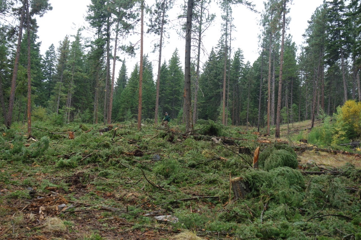
BNF called the Mill Creek logging a shaded fuel break, too. Person for scale in center.
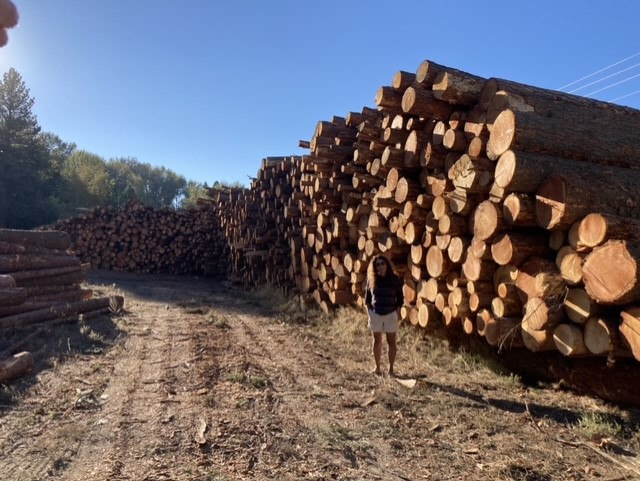
The log decks from the 2022 Mill Creek fire suppression logging.
In 2021, BNF also did clearcut logging at another fire, the Trail Creek fire, under the guise of fire suppression. It was 1.5-2 miles upwind of the actual fire and the fire never made it close to the fire line they had constructed.
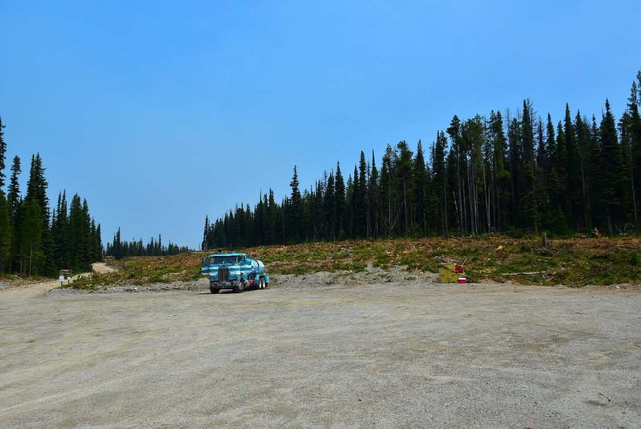
This clearcut was 150 feet wide by 8 miles long, done by BNF to “suppress” the 2021 Trail Creek fire. It was 1.5-2 miles upwind of the fire and the fire never even got close. This road, the Gibbons Pass Road, had been popular with cross-country skiers, but the clearcut opened it up to wind and increased snowmobile use, so the skiers have mostly abandoned it.
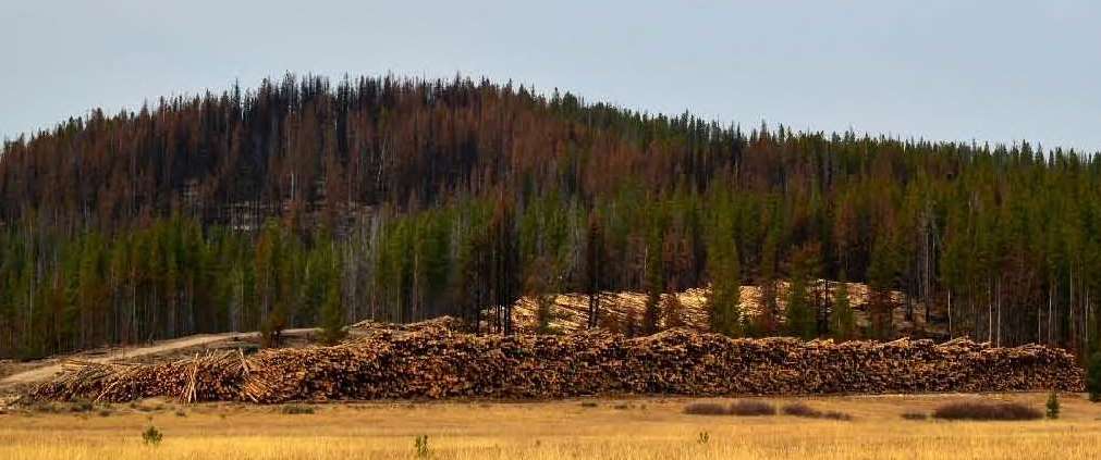
Above are log decks from the 2021 Trail Creek fire.
BNF has been using wildfires to justify lawless logging for at least the past 5 years. Are other national forests using the same tactic? We suspect so because, at least here in USFS Region 1, national forests are evaluated first and foremost on their timber production. If they cannot produce enough timber by following the NEPA process, they do it under the guise of a fire emergency when they can ignore NEPA and fund it with fire money. Not only are our publicly owned forests being lawlessly pillaged, the USFS is wasting enormous amounts of the taxpayer’s money to do it. At the same time, the USFS claims to have no money for clearing trails, for maintaining access roads and campgrounds, or for sufficient law enforcement to protect public lands.