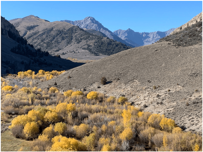
Looking up into the Lost River Range from above Dry Creek, into areas of the Burnt Creek WSA with the Borah Peak Roadless Area in the distance.
Maybe it was knowing the aspen leaves were falling fast, or intuition that there was trouble afoot – but I felt compelled to go to the Lost River Range country. Enroute to the Pahsimeroi, I was jolted to attention by a recently bladed Burnt Creek Wilderness Study Area border route that led into cherry-stems. The WSA was decorated with a shiny new sign, bordered by a heap of freshly bladed-up soil and sagebrush. My worst fears were realized as I drove west, headed into the upper Dry Creek-Long Lost Creek.
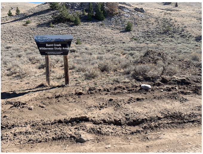
Nothing says “WSA” like blading off the sage and dumping a pile of dead sagebrush and dirt off to the side of a shiny new WSA sign. Challis BLM appears flush with funds for shiny signs, yet none to control off-road use that’s been proliferating in portions of the WSA.
FLPMA requires BLM manage WSAs “so as not to impair the suitability of such areas for preservation as wilderness“. The Burnt Creek WSA is to be managed by BLM to protect defined characteristics: Naturalness, Solitude, Primitive and Unconfined Recreation, and Special Features. During the agency’s excruciatingly prolonged Wilderness review process that spanned decades following the passage of FLPMA, BLM went to great lengths to exclude Idaho lands from WSA designation. The agency often used absurd excuses. An example: In non-canyon sagebrush country, BLM would expound at length about “a lack of visitor screening”. Heaven forbid that two hikers spy one another in the distance. Lands that survived the innumerable agency cuts were the best of the best. Vast areas of public lands were excluded by BLM for road footprints and/or livestock facilities deemed too intrusive. Exclusion was done in support of industry opposition claiming there was lots of oil or minerals or to please ranchers. But after running out of excuses, BLM finally was forced to include the 24,980 acre Burnt Creek WSA in its Final Idaho Wilderness Report stating:
The adjacent 116,000 acre proposed Borah Peak RARE II Area that lies to the southwest is spectacular. It gives the visitor the feeling of approaching the “top of the world” which seems to spread out as far as the eye can see (the recommended portion of the WSA shares a 7.5-mile border with the U.S. Forest Service wilderness proposal). The naturalness of the Burnt Creek recommended area is also outstanding. The primitive nature of the recommended area adds a spectacular example of sagebrush- and grass-covered hills with pockets of timber giving way to awesome rugged mountains rising into the adjacent RARE II Area. Both areas are dominated by the 12,655-foot Borah Peak, the highest point in Idaho.
Now smoking fresh aggressive BLM route blading has harmfully expanded the footprint of cherry-stem jeep routes in this WSA – up Long Lost Creek in the Little Lost River River watershed, and up Short Creek and Burnt Creek in the Pahsimeroi region. And perhaps I other areas I did not have a chance to go to.
There’s no doubt in my mind that BLM intended to purposefully degrade WSA values. The Challis office has a long history of trying to trash the WSA and the diminish the land’s suitability for Wilderness. Under the current political atmosphere, they feel unencumbered by any controls.
When I first contacted BLM, I was told by an assistant Manager that BLM didn’t know who had graded and expanded jeep route footprints in the WSA, and it wasn’t them. The visual effects of the road blading – white mineralized undersides of rocks and boulders, 3 and 4 ft. tall blading debris berms filled with upside-down old growth sagebrush, stark eroding side cuts – are shown in photos below and in linked videos. Then, after I e-mailed photos, BLM suddenly recalled they were indeed responsible for the blading. Here are examples of their handiwork.
Long Lost/Dry Creek WSA Blading-Dry Creek Allotment
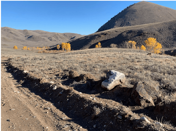
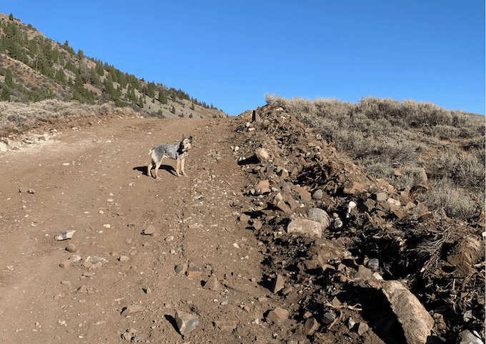
Heavy equipment dislodged and overturned boulders (often covered in colorful old growth lichens), exposing highly mineralized white undersides adding to the sharp visual intrusion of road cuts.
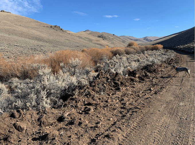
Bashed aspen remains amid heaps of dirt and sage – Long Lost Creek in the background.
Here’s also a video of the Long Lost blading.
Short Creek WSA Blading – Dry Creek Allotment
The scarring blading has resulted in many miles of bared soil cheatgrass invasion corridors inside the WSA. It currently contains minimal cheatgrass. This is Sage-grouse Priority habitat and occupied Pygmy Rabbit habitat.
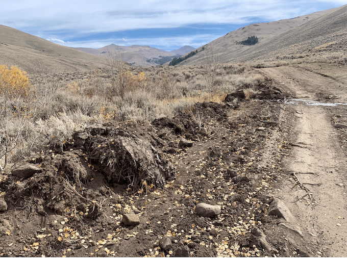
BLM is supposed to close off this Short Creek route inside the WSA starting October 1 when hordes of rifle hunters descend. You can see how serious BLM is about this closure, and compliance with it. How considerate of them to attack the WSA routes just in time for hunting season motorized mayhem in the Pahsimeroi – wouldn’t want a speeding ATV or Ram truck to hit a bump.
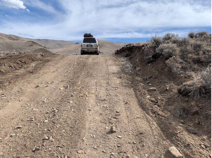
WSA jeep route on lower Short Creek inside the October 1 route closure. Very freshly killed and mangled old growth big sagebrush with leaves barely wilted on the left side. The sage had previously screened a vital meadow for Sage-grouse.
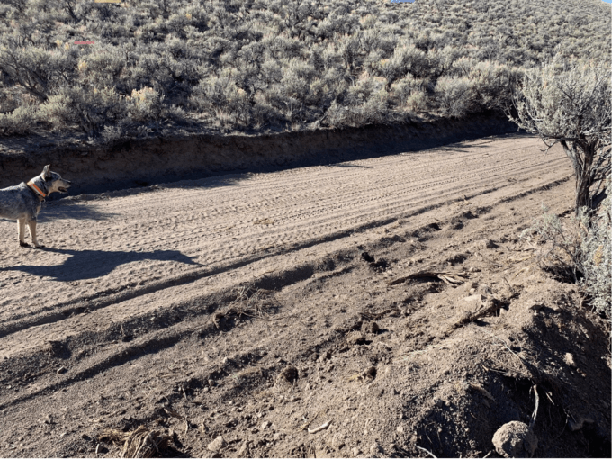
The WSA routes were dust bowls. The Pahsimeroi is increasingly seeing manic motorized use. Think of the erosion once a heavy rain or snowmelt hits. The new bank of dirt and killed sage in lower right is 4 ft. high.
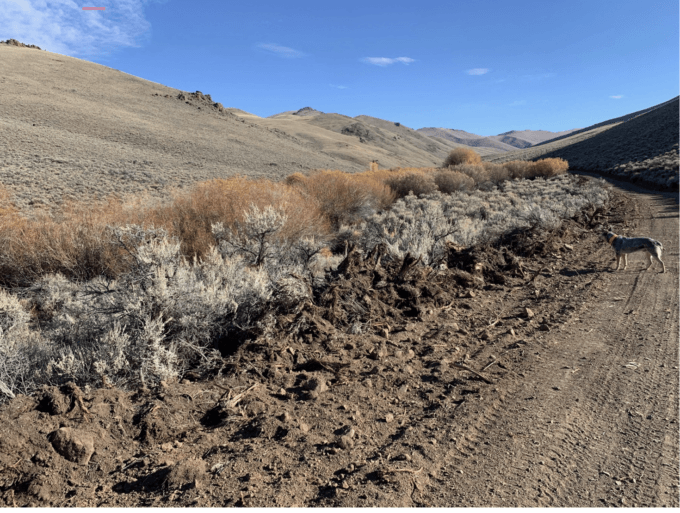
Blading by Short Creek. BLM is now trying to deceive us by saying this was“routine maintenance”. As if destroying mature and old growth big sagebrush was routine.
Here’s a video combination of road blading + cattle degradation of native Trout habitat on Short Creek: https://x.com/WLDdefense/status/2109739805714342268 .
Burnt Creek WSA Blading – Burnt Creek allotment
The Burnt Creek allotment is the site of past BLM efforts to intensify grazing and livestock facilities, in a steep Bull Trout watershed highly unsuited for cows, by building a battery of new cow projects. A small population of Bull Trout still persists. Water flows are limited, and it’s pretty much impossible to graze without lots of sediment entering the water. It’s also Bighorn Sheep habitat up high, vital Elk range, and occupied Pygmy Rabbit habitat with minimal cheatgrass (for now – but the road blading and sage destruction has created major new cheatgrass invasion conduits.
Road blading + Fence: https://x.com/WLDdefense/status/2108998285604389263
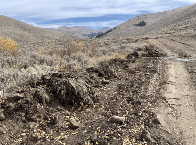
More BLM bashing and battering just upslope from a Burnt Creek tributary.
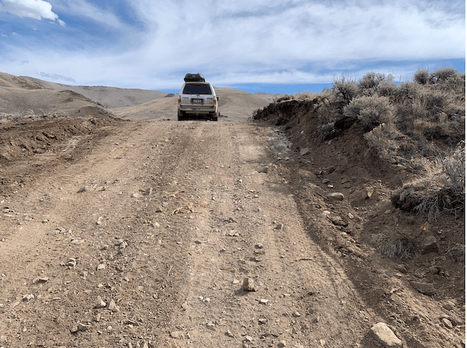
Jeep route converted to smooth sailing, cut bare soil cheatgrass expansion corridor.
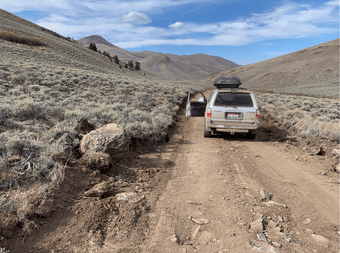
Bashed upturned boulder now with old growth lichens largely buried. The plant community here is almost entirely native without cheatgrass and other weeds before this blading. The Burnt Creek allotment is basically steep hillsides with a few springs, with the stream in an exclosure that periodically gets trespassed.
Burnt Creek WSA Blading-Upper Pahsimeroi Allotment
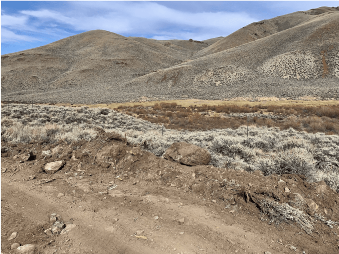
Burnt Creek watershed BLM sagebrush killing and boulder bashing.
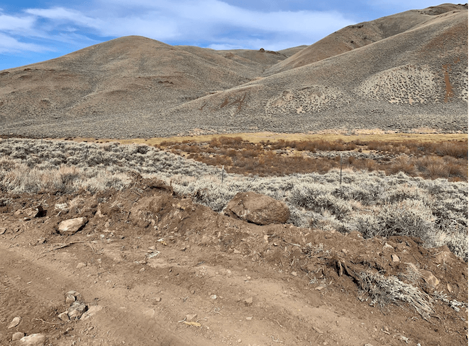
Around 12 years ago, BLM had carefully placed erosion control material and small pipes in some areas on the edge of the Burnt Creek cherry-stem route in the Upper Pahsimeroi allotment. The route runs close to the creek here and crosses small cattle-degraded tributaries. Over a decade ago, BLM had done an analysis to place barrier material and pipes and keep sediment out of Burnt Creek Bull Trout habitat. Those documents are now purged from the BLM website. In that analysis, BLM took WSA values into account. Challis BLM’s 2026 grading ripped the erosion prevention materials out. I found a larger piece of bladed up pipe chucked inside an exclosure fence to conceal it.
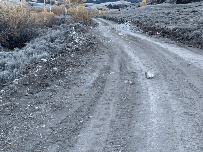
Wolves, Wolverines and other native predators will suffer even worse persecution as a result of BLM’s WSA attack. That too is likely part of why Challis BLM, tightly allied with such interests, attacked the Burnt Creek WSA. WildLands Defense, Alliance for the Wild Rockies and Native Ecosystems Council have written to the Idaho BLM Director saying BLM must return the WSA route footprints to their previous condition. The only response so far has been from Challis making the ridiculous claim that this was “routine maintenance”.
Meanwhile, the BLM’s website for the Burnt Creek WSA had stated in early October: “Vehicle routes in the WSA are not maintained, very rough, and can be muddy when wet. Though vehicle use in the WSA is allowed on existing routes, use on routes identified as closed or crosscountry vehicle use is prohibited. As vehicle routes deteriorate and become impassible, they will not be repaired to facilitate continued use”.
I just now checked the BLM WSA website. BLM is in cover up mode. They’ve speedily purged the “routes are not maintained” and won’t be repaired language after I pointed it out. I knew they would do that. We have a PDF with the original wording.
CHALLIS BLM WSA CATTLE GRAZING MANAGEMENT
As might be expected, livestock grazing “management” by Challis BLM has long been notoriously poor, degrading the WSA. Here’s what grazing under public land permits held by a wealthy hobby rancher from the Sun Valley area is doing to riparian areas and native Trout habitat in the Burnt Creek WSA.
Dry Creek allotment – Short Creek inside WSA
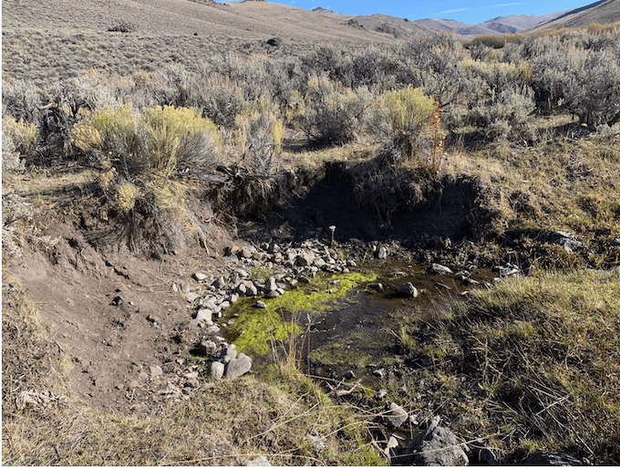
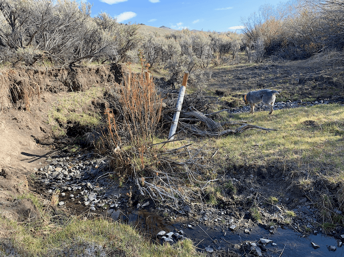
Stakes and some cut off willows placed around 5 years ago are part of a blown out ‘beaver dam analogue structure”. These have been promoted by The Nature Conservancy and NRCS under the ruse of effectively mitigating ongoing cattle grazing stream damage. In little streams like Short Creek, cows crash along the stream and trash the structures. Or if they stay largely intact, cows concentrate up and downstream from the structures, collapsing and eroding banks even worse. The trampling-caused bare eroding soil spills into the water. The structures also slow down water flow resulting in hotter temperatures, more evaporation loss, and reduced sediment flushing. The result is muck, and terrible water quality conditions for fish.
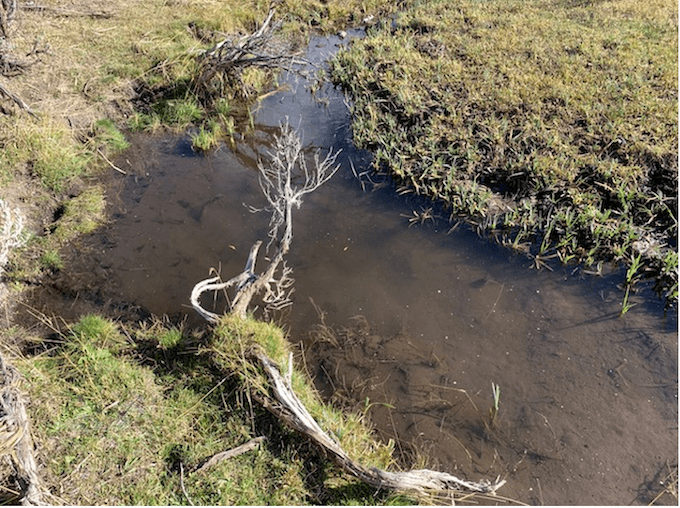
I watched Trout swimming. They churned up clouds of muck. Here’s a video It’s only because there are a couple of impenetrable ancient willow clump refuges upstream that the cows haven’t yet wiped out the fish.
Circa 1984, BLM built an exclosure above Short Creek at a declining aspen clone where young suckers were being devoured by cows. When I posted video of this, Lyle Lewis replied that he was instrumental in getting this aspen exclosure built, it made him persona non grata, and that he used the most durable fencing knowing Challis BLM wouldn’t maintain it. Here are 2026 photos of aspen inside vs. outside the exclosure.
Here’s the clone downstream of the exclosure – a stark demonstration of the effects of cattle grazing on aspen and biodiversity loss in the West.
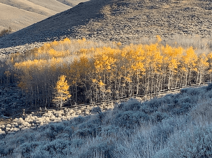
A straight line of aspen. Any suckers/ramets that tried to grow up outside the exclosure fence got devoured. The downstream fence is now failing, cows get inside. BLM ignores this.
This video also shows the aspen contrast.
Upper Pahsimeroi Allotment – Burnt Creek WSA Grazing
Back in 2022, WildLands Defense appealed the Challis BLM grazing decision for the Upper Pahsimeroi allotment. The appeal was making its way through BLM’s cumbersome system. Then last winter, Doug Burgum’s office yanked our grazing Appeal with no explanation. A variation on the Secretary’s American Prairie interference.
The permit is held by a wealthy permittee from the Sun Valley area. Cows are run in a very damaging way by a typical cattle manager. Huge herds of cows + all their calves are pushed back and forth in the allotment wiping out riparian stream cover and streambanks where they converge on water, gnawing back and battering willows, and grossly trampling spring and meadow complexes. Cows are also herded away from agency monitoring sites. Springs are treated as sacrifice areas by this operation, despite claims of espousing “conservation”. This chronic grazing abuse is incrementally killing surface water flows, reducing Sage-grouse nesting cover in Priority habitat, and ruining complex dense sage structure that protects Pygmy Rabbits in their heartland. The Pahsimeroi is where C. H. Merriam collected the Pygmy Rabbit “type specimen”.
Below are photos of cow impacts, not climate change, drying out and killing spring flows and meadows in this allotment. Springs in the Burnt Creek WSA across the Upper Pahsimeroi allotment are being unconscionably degraded by ongoing cattle grazing by a wealthy cattle operation that claims to embrace “conservation”.
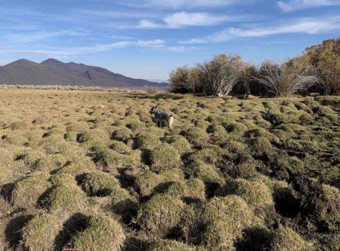
Expanses of hummocks caused by chronic cattle trampling surround dying spring and meadow areas. Ancient pedestaled cow-battered willows in background. Willows are only surviving because of thick wood at the base. Young willows routinely suffer severe browse use by cows.
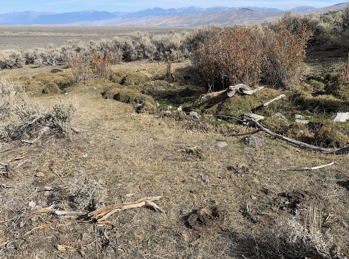
Cattle-caused WSA desertification in action.
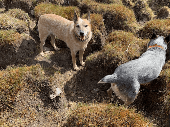
Yes, these are 2 ft. tall hummocks. Why isn’t it a crime to do this to springs and meadows on public lands?
Here and here are videos of some Upper Pahsimeroi allotment WSA springs.
Historical Note on Idaho Forest Roadless Areas and Wilderness, and A Fierce Defender
One of my first trips to the Burnt Creek WSA was with Sheldon Bluestein author of Exploring Idaho’s High Desert. As we were looking out over Dry and Long Lost Creeks, he said that Ohio Congressman John Seiberling had been to this spot on a 1984 helicopter tour of Forest Service roadless lands. Seiberling had marveled at the Lost River Range landscape and commented that it was like the Alps and must be protected. It hasn’t been. This was when the Forest Service RARE 2 roadless debate and possible Idaho wilderness designation were raging red hot.
In working on this, I stumbled across archived Corporation for Public Broadcasting Video coverage that captures the zeitgeist, with appearances by anti-wilderness villains. There’s nasty Congressman Larry Craig, timber industry lobbyist Joe Hinson seeking state control, and Senator Jim McClure with the perennial whine about outsiders. But then there’s Helen Trueblood humbly giving Seiberling one of Ted Trueblood’s books saying how much her husband had loved Wilderness. Trueblood used his platform writing for outdoor magazines to push land protection. He fought Sagebrush Rebel era attempts at a Public Land Grab, famously writing “They’re fixin’ to steal your land”.
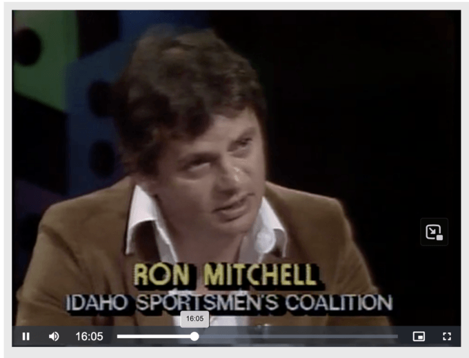
In the last part of the video (at 15:25), Idaho Sporting Congress’s Ron Mitchell sits tightly sandwiched between Joe Hinson and Larry Craig, painfully trying to be nice. You can see why Ron, who was an amateur boxer, abandoned efforts at niceness, and brought a series of smashing logging and clean water lawsuits. Over the years, as Ron fought for the land, well-heeled wilderness groups in Idaho were selling out wild places. They sucked up to then-Governor Jim Risch by supporting watered down Roadless Rule protections in Idaho, similar in ways to Trump’s Roadless Rule rescission scheme. This was done under the banner of “collaboration”. They’re still shamelessly boasting about it.
From a CounterPunch eulogy with a long list of Ron’s environmental achievements:
On a shoestring budget and with whatever resources he could muster, Ron waged a four decade-long war against those who threatened the wildlife, forests, streams and wetlands of the Northern Rockies. Be they politicians, timber corporations, or government bureaucrats, Ron took them on with a focused passion and unrivaled success.
And this: “He always said, ‘I did what I thought I had to do. Nothing more. Not much of a choice, really.'”
Be like Ron Mitchell. Face down the ravaging of the public domain.