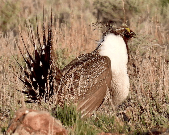
A sudden crazed lithium boom poses a grave threat to critical Sage-grouse habitats in the remote Nevada-Oregon borderlands of the McDermitt caldera. The proposed Thacker Pass lithium mine in the southern caldera by the Montana Mountains has gained international notoriety. Winnemucca BLM fast-tracked an EIS for an immense open pit lithium mine sought by Lithium Americas at Peehee Mu’huh Thacker Pass at the end of the Trump administration. BLM glossed over the mine’s death blow to wildlife (Sage-grouse, Golden Eagle, Pronghorn, Long Billed Curlew, songbirds) and to the region’s tiny springs and dwindling groundwater, and downplayed mine pollution. Meaningful Tribal consultation was forsaken for this mine that would desecrate a place of great cultural significance. The Biden BLM has dug in its heels, defending the mine to the hilt, blind to the importance of Life over Lithium.
The Thacker mine would destroy the last unburned lower elevation sagebrush habitat in the southern caldera. This sage is critical for Sage-grouse survival in hard winters. The bellwether Montana 10 lek (traditional breeding display site where birds return every spring) is only a mile from the mine site. Besides the obliteration and fragmentation of habitat, wildlife would endure non-stop noise, visual disturbance and behavioral disruption from industrial mine operation 24 hours a day for nearly 50 years. The mine has been entangled in litigation.
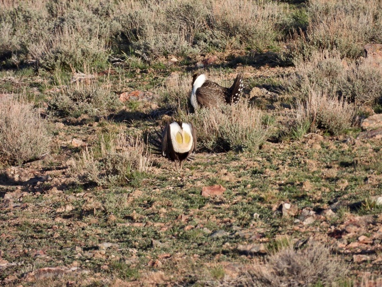
Montana-10 lek. Not very long ago, Nevada biologists believed as many as 10,000 grouse lived in the Montana Mountain/Lone Willow caldera area alone.
McDermitt Creek Lithium Claim Frenzy
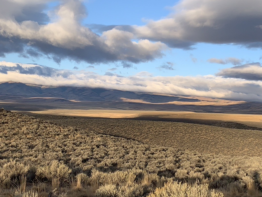
The sagebrush sea in McDermitt Creek Basin.
As the Thacker Pass EIS sped to completion, Australian miner Jindalee revved up lithium exploration drilling in the remote northern caldera just across the Oregon border. Ground zero for lithium speculators is a large sagebrush basin by McDermitt Creek. The basin is arced by dozens of Sage-grouse leks on surrounding slopes and benches and rimmed by the Oregon Canyon and Trout Creek Mountains. Disaster Peak by the southern Trout Creeks mesmerizes in views to the West.
Roaring noise, visual intrusion and habitat obliteration from a lithium open pit or strip mine in the basin’s heart would inflict grievous harm to the Sage-grouse population. A March 2019 Oregon Department of Fish and Wildlife map showed around 23 known leks (some may be complexes or inactive) within 5 km. of a 4800-acre Jindalee project boundary. ODFW overflights in 2022 detected more leks. Jindalee drilling operated through Hi-Tech Minerals, Inc.
The basin is critical Mule Deer and Pronghorn winter range, and Core Oregon grouse habitat, with sage understories still largely free of cheatgrass. Now its fabric is being incrementally torn and fragmented by scores of Jindalee and other lithium driller sites. Rig traffic has pounded formerly minor jeep trails into foot deep dust. Drilling disturbance of soils, protective biocrusts and mature sagebrush cover facilitates cheatgrass spread. 2012 wildfires burned vast areas of sagebrush across the caldera. Shrubs have not returned in many places. Mature sage community recovery takes many decades, making all the basin’s remaining sage critical to wildlife.
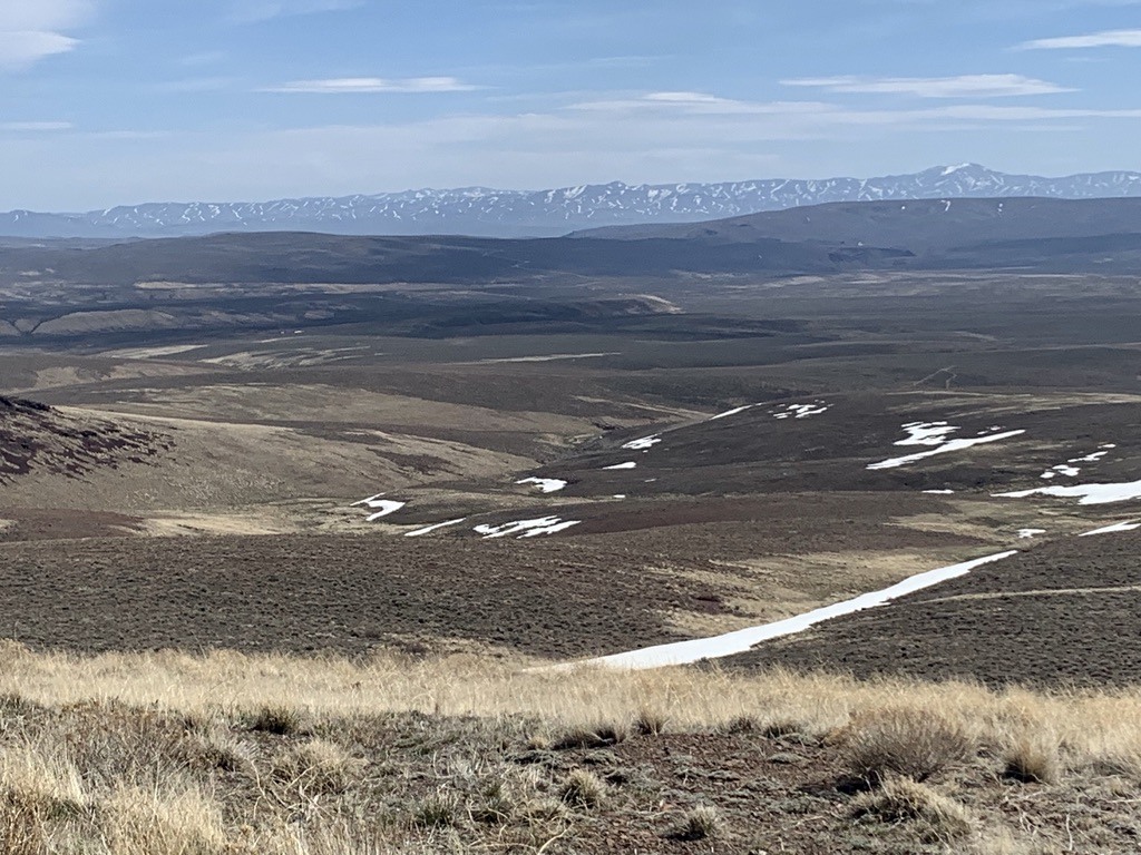
Looking across the basin into Nevada from near a lek, Santa Rosa Range running in the distance. Foreground grassy areas burned in the 2012 Holloway fire and have minimal shrub recovery. A gargantuan basin mine built here would be very visible from the overlooking leks. Sound would travel unimpeded. Blasting, excavators rumbling 24 hours a day, glaring night lights – all would produce a massive disturbance footprint emanating from an amphitheater of lithium mining ruin below.
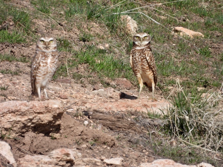
Beautiful Burrowing Owl pair by rock outcrop burrow. Sage-grouse strut on an unmapped lek a few hundred yards east. New claim stakes have encroached very close to their burrow home.
Undertaking a Non-Undertaking, and other Adventures in BLM Regulatory Bizarro World
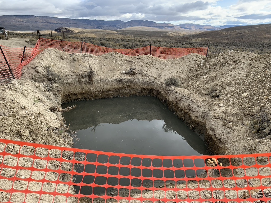
Jindalee drilling Wastewater sump pit. In response to my complaints, BLM found no concerns with sump water contaminants, but admitted problems with faulty fencing that’s supposed to prevent wildlife drowning or becoming mired, or cows breaking their legs. I observed inadequate or collapsing fencing at many sumps.
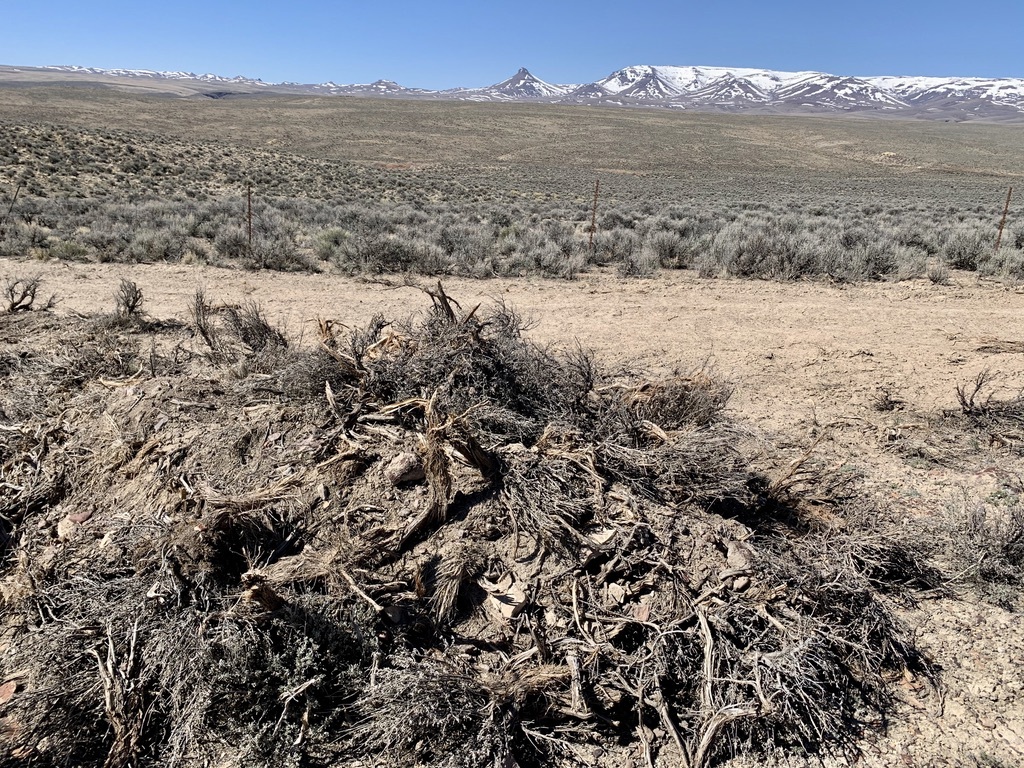
A Whodunit. Bulldozed sage by route bladed wider in area dense with Jindalee drill sites. Dead sage still had attached dry leaves in 2021. When I inquired, BLM tried to claim it could have been killed years prior by EPA accessing toxic mercury sites.
More images of caldera habitat ripped up by lithium exploration in this non-undertaking here, here, here.
BLM’s 2015 Sage-grouse plans identified the basin and much of the caldera as Sage-grouse Focal and Stronghold habitat – the best there is. Now it’s being butchered piecemeal by lithium drilling. BLM mining regulations contain a giant loophole that exempts drilling exploration projects conducted under a “Notice” filed by a miner from environmental review. BLM allows up to 5 acres of disturbance (actual dug up land and/or destroyed surface vegetation) done under a Notice to be exempted from NEPA environmental analysis and public comment. BLM sits back, says the 1872 Mining Law ties its hands, and its powerless to prevent such damage.
NEPA environmental study only occurs when a mining company proceeds to a “Plan of Operation” stage which typically has great amounts of disturbance. BLM Jindalee correspondence recites language from the agency’s 2015 Sage-grouse plans:
“If a Plan of Operation is filed on mining claims in PHMA or GHMA [grouse habitat categories], identify and evaluate mitigation measures to avoid or minimize adverse effects … through the Plan of Operation NEPA process … For notice [Jindalee exploration] … apply RDFs (to the extent consistent with applicable law)… For locatable mineral projects such as yours the BLM cannot require that these be followed unless undue or unnecessary degradation is created but can be provided as recommendations to the operator …”.
Excessive damage to soil or cultural material is specifically listed under the undue degradation part of BLM Jindalee paperwork. But Sage-grouse and other wildlife receive no mention there. Impacts are definitely not “minimized”. Drilling time periods did avoid nesting periods, but BLM records I reviewed don’t indicate a single drill site moved to protect integrity of Sage-grouse or any other animal’s habitat. In fact, BLM allowed drill rig cross-country driving smashing and killing sage so Jindalee could punch drill holes into very high-density grouse use areas, and never looked for Pygmy Rabbits or any other species.
Lithium Hell descended on the basin in August 2018, when BLM signed off on the company’s initial 5-acre Notice filing for exploration drilling. BLM knew there were cultural and Sage-grouse conflicts from the start. Its 2018 “Operating guidelines to prevent unnecessary and undue degradation” stated “cultural resource surveys were conducted. Of the 34 proposed drill holes, pads, access routes, artifacts were found at 29 of these locations, as well as along some access routes”. Jindalee plowed ahead with drilling 4 initial sites. The company and BLM failed to get required advance permit authorization from the Oregon Department of Geology and Minerals (DOGAMI). Early 2019 e-mails show the state trying to figure out what was going on. An Oregon state archaeologist, or SHPO (State Historical Preservation Officer – “ship-o”) letter referred to Jindalee applying for after-the-fact authorization. The SHPO sought clarification for 30 other drill sites, said the area had high potential for cultural sites, asked that all activities cease, and Tribes be properly notified. The SHPO expressed serious concern with BLM greenlighting a project without consulting their office, and that consultation was required for all projects affecting cultural resources.
In a flurry of internal e-mails, BLM smugly clung to its interpretation of the regulations – that a claim holder can file a Notice and rip away with heavy equipment smashing sagebrush, excavators digging vile sump pits and disrupting cultural locales – until a magical threshold of 5 denuded acres is reached. Only when this “exploration” exceeds 5 acres does mining exploration become an “undertaking” and “federal action” on public lands. A BLM e-mail shows this willful blindness to environmental harm:
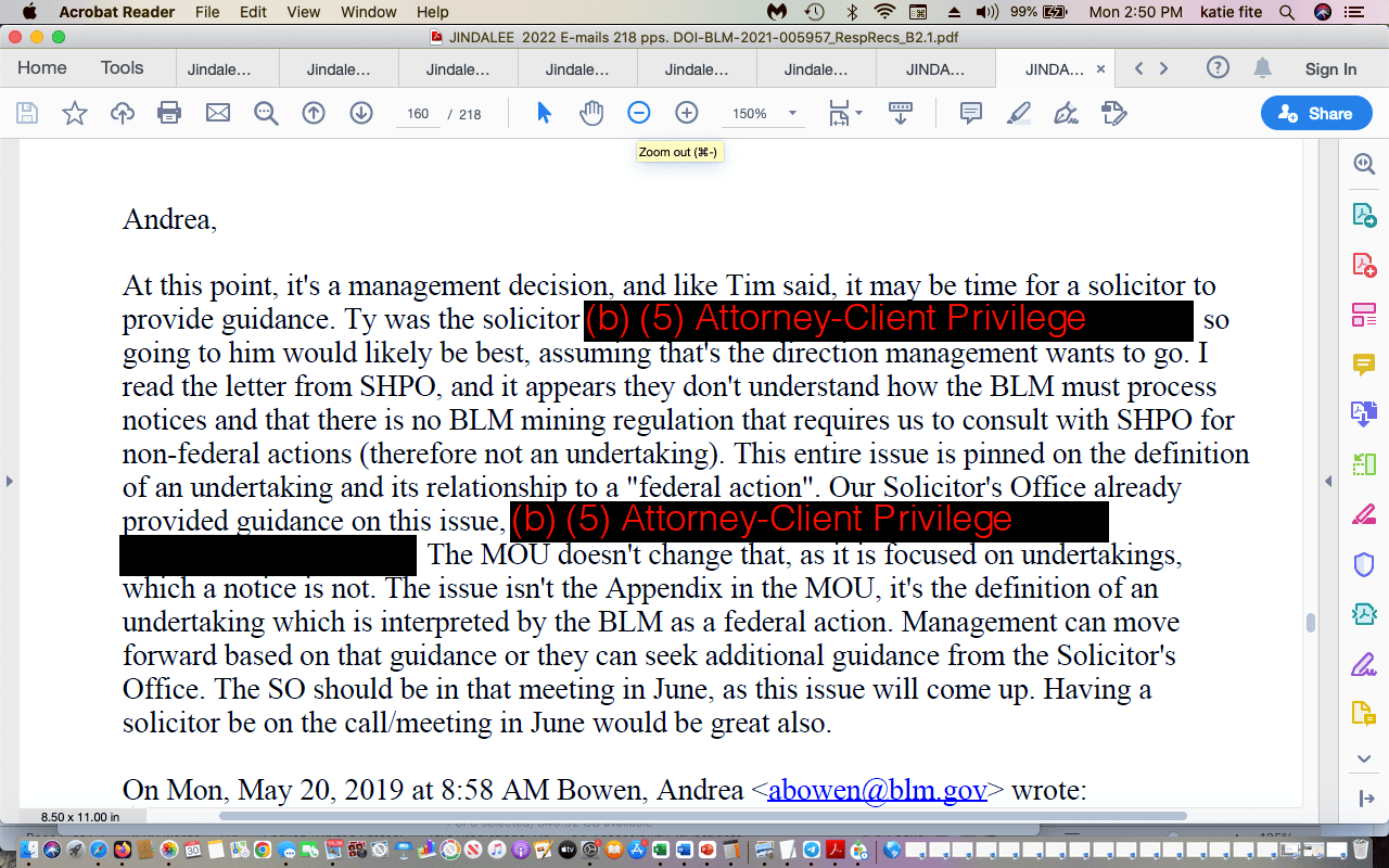
Vale BLM Manager Ryan replied to the SHPO, reiterating “mining notices aren’t an undertaking”. Well, it turns out that Deb Haaland just ordered that these 5-acre Notices must be provided to Tribes. So what other parts of BLM mining oversight and “non-undertaking” bulldozing aren’t actually set in stone by the Mining Law, and should be changed ASAP, to protect biodiversity, Sage-grouse and the public interest?
BLM also stood firm that authorizing drilling to proceed is not a “decision”. A later SHPO letter said BLM hadn’t recorded or evaluated discovered cultural sites or shared information. It emphasized the significant scope of drilling across 10 sections of land (this eventually ballooned to 13 sections) across thousands of acres Indeed. For wildlife, drilling and fragmentation spreads flammable weeds, increases nest predation vulnerability, drives animals away. An industry article, now vanished from the internet, quoted a mining company spokesman saying how “chuffed” he was, and essentially how easy it had been to push drilling through. Oregon prides itself on having good mining laws, but they do little to prevent or effectively minimize what lithium exploration drilling has done to Core Sage-grouse habitat in the basin.
Loopholes Within Loopholes
After BLM ok’d the initial 5-acre Notice and drilling phases perforating a 4800-acre project area, it allowed Jindalee to add a third drilling phase when they requested 2.5 more acres of disturbance and expanded perimeter. To enable this expansion, BLM found that habitat ripped up just a year or 2 before and re-seeded was miraculously “reclaimed”. If a site had some scruffy plant cover, it was declared “reclaimed”, with acreage calculated to several decimal points. This mathematical exercise found only 5 acres of disturbance would exist with Jindalee drilling over 5 acres. Even places dominated by povertyweed or halogeton were pronounced reclaimed, freeing Jindalee to use the initial Notice loophole to “disturb” sensu BLM greater than 5 acres of Sage-grouse Focal and Oregon Core habitat without NEPA or public comment. A BLM staffer worked during vacation to speed Jindalee paperwork along, while the agency stone-walled my concerns.
The company told BLM that 60 or 70 drill holes now piled under the initial Notice (with the project areas expanded over thousands more acres) would be completed in summer 2022. Tracking exact drill site numbers is difficult. Mapped sites get shifted around if cultural materials are present, but without regard to Sage-grouse impacts. 1 or 2 drill sites were moved because they were inside a Wilderness Characteristics Unit – highlighting how greatly lithium mining in the basin would clash with wild lands protection. It’s hard to experience solitude and other Wilderness values next to a 24 hour a day mega-mine.
In fall 2022, BLM files show Jindalee cramming in a new 600 feet deep water well with 75 gallons per minute flow, plus new brush-hog mutilation of sagebrush, under the 2018 Notice. That’s 105,000 gallons/day and 38 million gallons annually in the over-allocated Quinn River watershed. Records show the well as “temporary” for 5 years. Will the temporary well get rolled into permanence later? Will other lithium drillers access this water? Will there be mercury or radioactive material in the water? There’s also the messy matter of mining impacts on a strained borderland aquifer affecting water right holders in 2 states, and flow worries in a Lahontan cutthroat trout watershed. a segment of McDermitt Creek downstream lies in Wyden and Merkley’s proposed Wild and Scenic River Democracy bill. I’m new to mining minutia, but given loopholes in BLM regulations, Vale oversight, and the lithium rush atmosphere, anything seems possible.
Records show BLM contemplated requiring a “plan of operations” (and finally NEPA?) for Jindalee, before allowing more than 5 acres of drilling under the old 5-acre Notice. True to form, the agency came down on the side of foreign miners, not the birds. In late 2021, Jindalee informed BLM it was working on a “Conceptual Project Description” across 9,050 acres (14 sq. mi.) of the basin – with new road building and major drilling. In February 2023, Jindalee filed an “Exploration Plan of Operations” – likely for 9000+ acres. I attempted to review project files in the Vale office, but much information was absent. Intensified lithium drilling disturbance will be catastrophic for the irreplaceable basin Sage-grouse habitat.
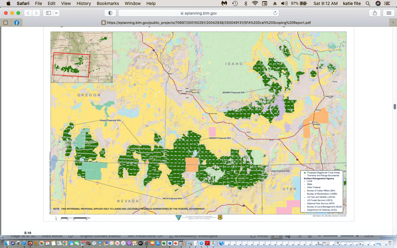
Focal habitat (dark green). Fish and Wildlife Service found a Mineral Withdrawal was essential for Sage-grouse population persistence. Lithium greed wrecking the McDermitt caldera would leave an isolating gulf between Sheldon-Hart and the Owyhee region.
Feds Fail Sage-grouse
The Obama-era 2015 Sage-grouse plan Final EIS included a proposed federal mineral withdrawal prohibiting mining in Focal habitat in the Mcdermitt basin and over much of the caldera. But alas, BLM added the withdrawal too late in that plan’s NEPA process. It was struck down in court after the mining and livestock industries sued in Nevada. In response, BLM began a separate new EIS, but only got to the draft EIS stage. Trump swooped in and canceled the withdrawal process.
Then came a new February 2021 ruling in a separate Sage-grouse lawsuit challenging Trump quashing the withdrawal “the cancellation was then vacated by the Court on February 11, 2021 (Western Watersheds Project v. Bernhardt) …. The Court ordered the BLM to consider “whether the withdrawal is needed for sage-grouse conservation,” and that “such proceedings shall include re-initiation of the NEPA process.” Needed? Just look at what’s taking place in the McDermitt caldera!
The court laid out why US Fish and Wildlife Service in 2015 had found Sage-grouse didn’t require listing under the Endangered Species Act: “FWS explicitly relies on the BLM and Forest Service’s conservation efforts, including the proposed withdrawal, in finding that the listing of the sage grouse as a threatened or endangered species “is not warranted at this time”. The court used Fish and Wildlife Service’s own words:
“Within the areas of greatest conservation importance (SFAs), DOI will recommend withdrawal from locatable mineral entry. We support the recommendations for mineral withdrawal in SFAs that would remove potential impacts on approximately 4 million ha (10 million ac) of sage-grouse habitat … These measures minimize mining impacts in priority habitats for the life of the management plans … Based on what we know today, no mining activities are likely to result in loss of these important areas for conservation … Therefore, the long-term protection of the sage-grouse habitat in the SFAs from locatable mineral development will ensure that these important populations are conserved into the future”. (SFAs = Focal habitat). Flash forward to 2023. Now lithium mining is assaulting caldera lands long identified for conservation, with a bullseye drawn on the most scarce and precious remaining sage sites.
After the February 2021 court order, the Biden BLM issued a scoping notice in summer for a new withdrawal EIS. This appears to be willfully stalled. BLM is apparently using a broader Sage-grouse plan revision to delay moving the withdrawal EIS forward. The February ruling occurred before BLM let Jindalee squeeze in more than 5 acres drilling under the Notice loophole’s “reclamation” loophole.
The Mcdermitt exploration saga illustrates how mining companies, operating under BLM’s wretched regulations, can run roughshod over pliant bureaucrats and the public interest. Miners operate for years under the radar free from public knowledge and environmental review. The company’s relationship with BLM staff becomes cozy. By the time an EIS for a full blown mine gets produced, habitat has been harmed. BLM will then turn right around and say land it aided and abetted being damaged now has lower value to wildlife. Mining companies are experts at this game of skewing the baseline and screwing wildlife. They muck around drilling for a few years with many modifications to an initial Notice. Each drill round drives away more animals, chews up more habitat, and lowers its quality. Trashed habitat = reduced mitigation $$$ when a mine is built. Miners boast about each drilling bout in the trade press, reeling in investors. And of course, “mitigation” schemes don’t really work for Sage-grouse, a landscape bird with complex seasonal and spatial needs. Effective mitigation for loss of the caldera basin habitat would be impossible.
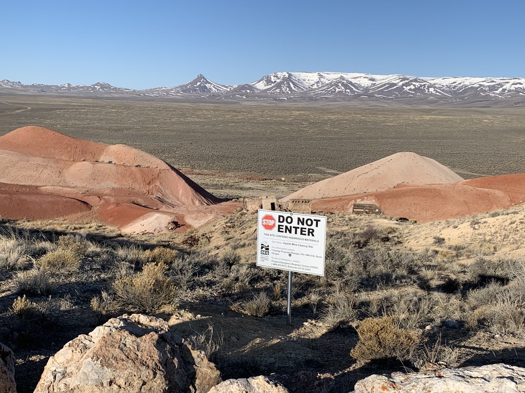 Looking past the Opalite mercury site’s toxic rocks into a Jindalee claims area, Disaster Peak and Trout Creeks in the distance.
Toxics Lurk in Caldera Soils
There are now other Notice-level drilling schemes moving forward. Oregon Energy LLC and FMS Lithium LLC projects are also being exempted from NEPA under separate 5-acre Notice loopholes, with no public process to disrupt BLM doing the miner’s bidding. Other companies have also staked areas. Oregon Energy is drilling for a horror-show combo of lithium and uranium, near an old mercury mine (Bretz mine and Aurora site). Jindalee and FMS claims are near the Opalite mine, with its toxic rocks. There sure could be fearsome contaminants in the roiling dust clouds, drainage discharge and emissions from caldera mining. It seems unwise to unleash what’s sealed in old supervolcano deposits at the birthplace of the Yellowstone hotspot.
Mercury spoils were hauled to the little town of Mcdermitt and the Fort Mcdermitt Paiute and Shoshone Reservation, used on streets by homes, spreading toxic material far and wide. Taxpayers were later on the hook for “remediation” both in town and at the basin mercury sites. Sadly, there’s no way to remediate the health toll of the prolonged human toxic exposure.
Oregon Energy floated uranium mining at the Aurora site back in 2012. The Oregonian reported:
“Malheur County targeted for gold, uranium mines. Australian-owned Oregon Energy LLC hopes to mine 18 million pounds of yellowcake uranium from the southeastern Oregon high desert …“Oregon Energy’s proposal calls for extracting ore from a mile-long, 600-foot wide, 250-foot deep open pit … 3 miles north of the Oregon-Nevada border. The mine, adjoining the former Bretz Mercury Mine, a contaminated open-pit site from the 1960s … Plans call for the ore to be crushed and mixed with an acid solution in enclosed vats to leach out the uranium … The acid would bond with the uranium and when dry become a sand-like powder called uranium oxide concentrate, or yellowcake. …”
The article quotes environmentalist and mining activist Larry Tuttle, who I learned in writing this had passed away. He predicted Aurora uranium processing would have downwind mercury fallout:
“Tuttle, spokesman for the Portland-based Center for Environmental Equity foresees environmental problems. The likelihood of sulfuric acid being used in processing the ore means it could remain in the mine tailings after milling, he said. The snag is that sulfuric acid tends to continuously leach out heavy metals that occur naturally in waste rock and tailings, contaminating ground water. “Just because you are through with the processing, years later you still have the issue with that interaction,” he said. But probably the biggest environmental hurdle for the Aurora mine would be the release of mercury, Tuttle said. “The whole Owyhee Reservoir has been affected by naturally occurring background mercury,” and uranium mining could release more…”. Owyhee Reservoir provides irrigation water for 1800 farms across >100,000 acres in Oregon and Idaho.
More About Larry Tuttle’s Work
Willamette Week’s A Glowing Opportunity on Oregon Energy’s Aurora uranium plans quoted Tuttle: “I can’t think of a clearer example of what’s wrong with federal mining law,” says Larry Tuttle, director of the Center for Environmental Equity. “No one was talking about nuclear weapons in 1872 when the law was passed.” I remember Larry speaking at Malheur Field Station Desert Conferences. Living on Earth tells of his 1872 mile Portland to Denver walk via hardcore Salmon (where the Forest Service today is handing out cobalt, gold and other explo permits like candy), raising awareness of the harms and inequities of US Hard Rock Mining Law. His work spans the struggle for state mining reform in Oregon which he drove, the absurdities and perils of the mining law as illustrated by Aurora, busting salvage logging myths of bug-proofing forests, challenging the orthodoxy on environmentalism:
“As an environmentalist, I was surprised at Ed Marston’s conclusion … that “the goal of environmentalism was never to achieve a cultural revolution.” Silly me. I thought I was part of a social movement with a goal of enacting fundamental social and economic changes – changes that are necessary to break the historical cycle of abuse of public lands and resources”.
There are several articles by or about Tuttle at Counterpunch, including the mining takedown in Something about Butte: “Tuttle may be the mining industry’s biggest pain in the ass”.
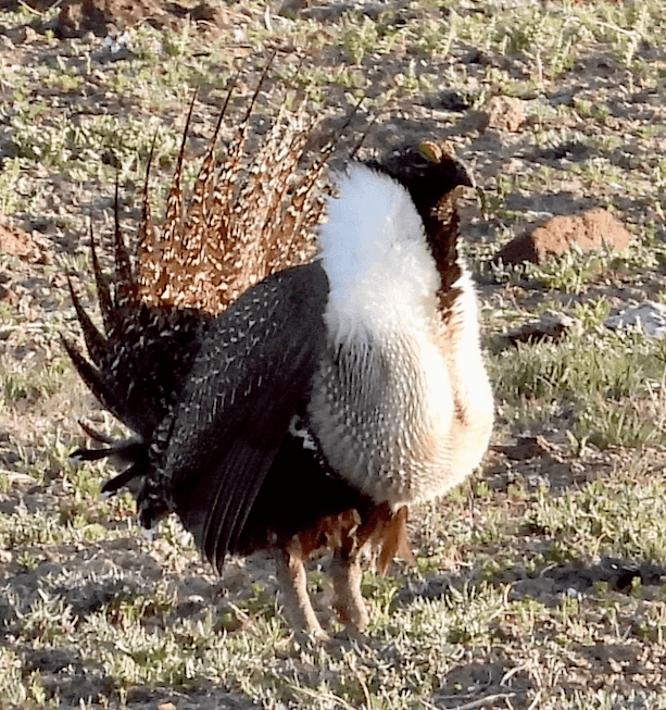
This fellow seems like a tough hombre, too. He’s on a McDermitt basin lek not shown on BLM mapping, very close to new claims. At least 16 birds here.
Larry Tuttle helped beat back the proposed Newmont Grassy Mountain gold mine:
“For the time being, eastern Oregon remains free of gaping pits, cyanide ponds and 600-foot tall mounds of crushed rocks. The Browns and Tuttle showed that determined opposition and a belief in attacking corporations head on can win the day, as they banished North America’s largest gold mining company from the state of Oregon”, excerpt from Red State Rebels: Tales of Grassroot Resistance in the Heartland.
I watched gold fever strike the northern Owyhee with Newmont’s hype. It provoked a white plastic pipe claim staking spree reminiscent of today’s lithium madness. Claims sprung up over 100s of square miles from Succor Creek to far beyond Grassy Mountain. Uncapped pipes still litter public lands luring curious birds and bumblebees to their doom. Animals fly into pipes (attracted to wind whistling through side holes or for roosts). They can’t fly straight up so there’s a death pit at the bottom with desiccated husks of Shrikes, Bluebirds, Rock Wrens. One of the few recent changes in public lands mining is stakes have replaced killer pipes.
Grassy Mountain gold has now risen from the dead – OPB reported on Paramount Gold collaboration with Vale BLM. The article’s photo of Grassy Mountain today – after endless “exploration” – illustrates what more exploration phases could do across the McDermitt basin. Here’s hoping for activism with Larry Tuttle’s spirit to shake up today’s placid public lands mining scene in Oregon!
The caldera is one of the vanishing few areas of the West where a high lek density remains.
Not so long ago, Nevada wildlife biologists believed 10,000 Sage-grouse inhabited the Montana Mountain/Lone Willow population alone. Numbers are drastically down – due to fires and rehab failures, grazing degradation, killer fences, and BLM “treatments” of sagebrush. One of my early Oregon Canyon trips was for an appeal (unsuccessful) of Vale’s explicitly stated plan to burn up old growth sage so cows could easily clamber to streams.
+++
Use of amended 5-acre Notices is rife. Politicians embrace of pick and shovel era mining law is pervasive. Harry Reid infamously blocked mining reform, and the tradition continues. Oregon Congressman Cliff Bentz’s brother is prominent in the Oregon Mining Association. A Trump appointee, long-time Oregon Farm Bureau head Barry Bushue, remains Director of the Oregon-Washington BLM. Trump appointee Jon Raby still heads Nevada BLM. The moorless Biden BLM continues many of the most ecologically harmful actions from Trump’s Interior. Added in is a cult-like mindlessness that ignores biodiversity destruction caused by anything related to industrial scale “green” energy – witness the recent scene of federal officials rapturous over yet another transmission line facilitating industrial solar rape of desert lands.
Lithium Boomers Busted by Steens Mineral Withdrawal
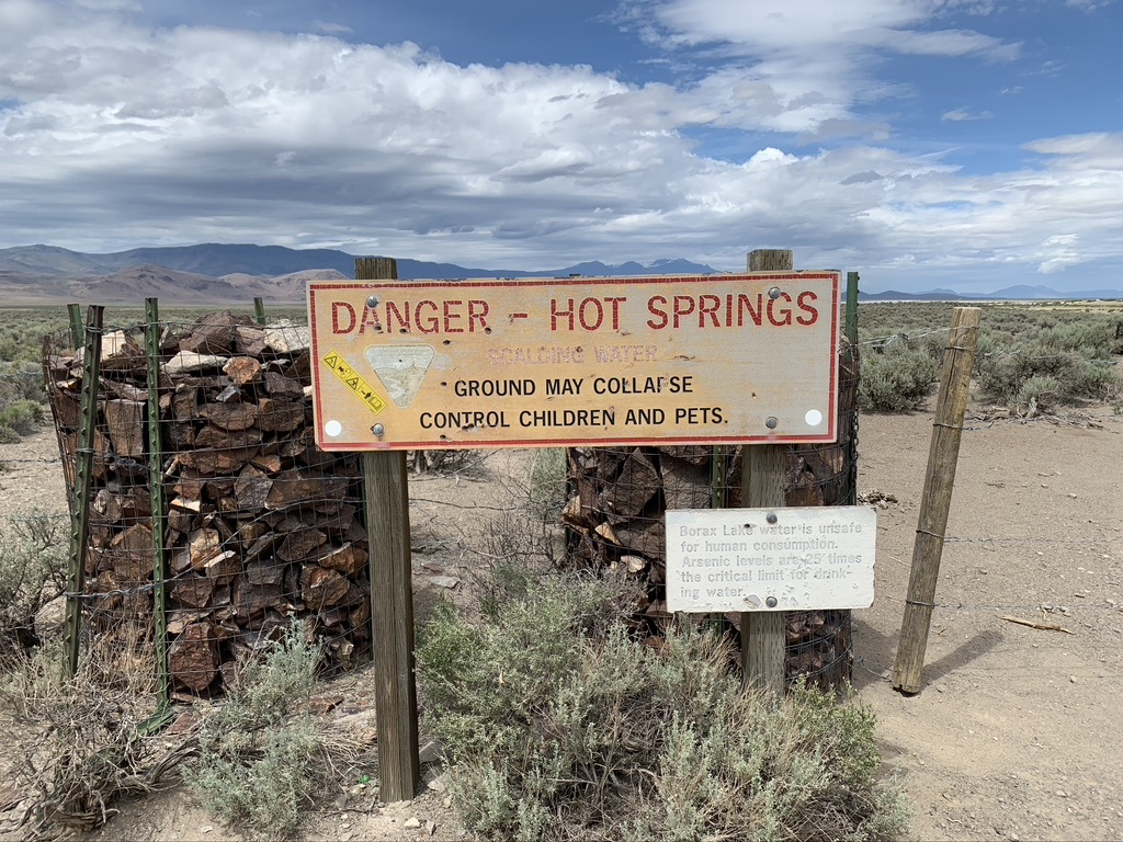
Borax Area of Critical Environmental Concern – scalding and arsenic-laden waters.
Now for some good news down in Alvord desert Kit Fox country on caldera-derived deposits. These public lands withdrawn from mining and geothermal development by the Steens Act legislation over 20 years ago were heavily staked by Australian lithium speculator Reedy Lagoon. OPB described this:”9,000 acres surrounding Borax Lake and on the southern portion of the Alvord Playa, a dried-up alkali lakebed, and Reedy Lagoon made its initial pitch to investors”. Reedy didn’t do its research before making triumphant posts about scads of Alvord claims. Burns BLM rejected the claims, and those of ACME Lithium near the Whitehorse Ranch. Both lithium flashes in the pan had proposed brine operations that use a massive amount of water.

Reedy claims stakes, accompanied by cross-country tracks across Alvord desert soil.
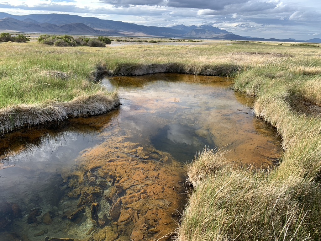
Without the Steens Act’s geothermal and mineral withdrawal, this unique Alvord ecosystem, home to the endemic Borax Lake Chub fish, would be vulnerable to mining and geothermal development schemes.
It’s long past time for a mineral withdrawal in Sage-grouse habitats of the McDermitt caldera region and beyond, an action Interior knew was necessary to ensure the bird’s survival 8 years ago. A recent mineral withdrawal in the Boundary Waters made a big splash in the news. The lithium frenzy has created an emergency for Sage-grouse. What emergency powers can the Secretary wield that could prevent destruction of caldera habitats? Will Interior ever live up to its commitments to Sage-grouse preservation? Or will it capitulate to industry, foot-drag and let the birds fade to extinction?
+++

Disaster Peak watches the high desert spring come. Grouse strut on leks below, Deer herds and Pronghorn follow snowmelt, Sagebrush Sparrows arrive in basin and tiny wildflowers grouse hens nibble for nesting nutrients emerge.
All photos by Katie Fite.