
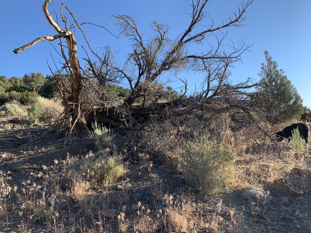
Photo: A Cooper’s Hawk nestling on the verge of fledging. Forest Service zeal for year-round prescribed fire is barbaric. Why isn’t premeditated helicopter napalming of forests in spring a crime? How many birds will a 10,000 acre Forest Service June fire “take”?
Fire Fever Grips the Intermountain Region
The Forest Service Intermountain Region 4 just released a barrage of cookie cutter NEPA documents aiming for a tremendous increase in Forest-wide prescribed burning across the Salmon-Challis, Sawtooth, Caribou-Targhee, Humboldt-Toiyabe, Manti-La Sal, Fishlake, Dixie and Ashley Forests.
The projects span millions of acres of rugged, dramatically beautiful arid forests and shrublands. It turns out these fire projects may be used as justification for pre-burn and post-burn logging under separate piecemeal NEPA decisions. Roadless Areas are primary targets. The Forest Service claims vast swaths of Roadless Areas are greatly “departed” from their modeled ideal, have “missed fires”, haven’t burned nearly enough, or trees are dense so there’s too much fuel. Being branded “departed” is the kiss of death. Claimed Roadless Area “departure” highlights the use of spurious USFS-BLM-Nature Conservancy LANDFIRE black box models with their purported pre-settlement fire intervals and broad brush fuel estimates. Roadless Areas are some of the least likely places for fire suppression to have occurred or been effective. Such models are being universally applied by agencies in support of the official narrative that fire suppression causes big western wildfires.
The Fire Environmental Assessments (EAs) march in lockstep in their mission to drastically alter mature and old growth woody communities across the Region, from Whitebark Pine to Ponderosa Pine to Greasewood. The Caribou-Targhee EA states that 84% of “departed” lands are late seral habitats, which are required by so many rare animal species across the Intermountain West. These communities are crucial for sequestering carbon, which will indeed depart into the atmosphere if the EAs stand.
Roadless Areas across the Salmon-Challis, Sawtooth and Caribou-Targhee Forests have long been proposed for wilderness designation in the Northern Rockies Ecosystem Protection Act (NREPA). The same questions must be asked about prescribed fire as any other agency project. What species habitats and wild areas will be harmed? Who profits? How bad will it turn out?
Grouse, Owl, Carnivore, Migratory Bird Habitats Up in Smoke
The EAs include irreplaceable Sage-grouse habitats of the Humboldt-Toiyabe, southern Sawtooth, Salmon-Challis and a sliver of the Dixie Forest; Bi-state Sage-grouse lands on the California-Nevada border; unoccupied Gunnison Sage-grouse range in the Manti-La Sal; and the ever-shrinking Sage-grouse and Columbian Sharp-tailed Grouse habitat of the Caribou-Targhee. Groves of old conifers whose needles are relied on by Blue (now called Dusky) Grouse for winter survival are threatened. Some EAs openly plan to destroy sagebrush, while others plot to fragment sage with firebreaks, pile burning and other cheatgrass expansion activities.
Boreal Owls and Great Gray Owls in the Sawtooth and Salmon-Challis, California Spotted Owls in the Humboldt-Toiyabe eastern Sierras, and even a smidgen of Mexican Spotted Owl habitat in the Manti-La Sal Monticello country will be impacted. Flammulated Owl forests across the Region are at risk.
From the Wolverine wilds of the Sawtooth and Salmon-Challis, to the Sierra Nevada Red Fox habitat of the Humboldt-Toiyabe and Canada Lynx lands of the Caribou-Targhee, the dense woody cover and downed wood the Forest seeks to obliterate serves as a barrier limiting human intrusion. It also restricts domestic livestock penetration of remote habitats. In Idaho, where vicious Wolf persecution rages, stripping protective woody cover would increase gunning and trapping access ease.
Woe be to the Pinyon Jay, Gray Vireo, Ferruginous Hawk or any other Pinyon-Juniper forest species whose habitat so far has managed to escape past chaining, mastication or chainsaws. Yellow Warbler, Willow Flycatcher and Black-headed Grosbeak riparian areas are fair game, and the EAs make excuses for incursions into Bull Trout and other aquatic species habitats. The Fishlake and Dixie projects would purposefully burn riparian areas where sideslopes are less than 40%. Brewer’s Sparrow and Pygmy Rabbit too-thick-to-walk-through “departed” sagebrush is also soon to be ash.
The Forest Service isn’t just talking about burning standing trees and shrubs here. This is the fire version of Donald Trump’s forest raking. Burn preparation includes: Slashing, hand thinning, piling, pile burning, cross-country motorized vehicle travel, and mastication. There’s also potential linked pre-treatment logging under separate NEPA:
“where specialists determine that fuel loading and/or stand structure is such that prescribed fire behavior might exceed acceptable thresholds and pose risk to prescriptive objectives and/or highly valued resources and assets (wildland-urban interface, infrastructure, or sensitive resources, etc.)”.
Note that several Forests have giant WUIs to facilitate clearing and logging, like Salmon-Challis with its whopping 1.1 million acre “wildfire protection zone”. Preburn actions will be followed by helicopter and/or ground ignition and underburning, broadcast burning, jackpot burning, more pile burning and/or tree well burning followed by potential seeding and a repeat of this all as “maintenance”.

* In the Humboldt-Toiyabe the description of sage disturbance includes breaking up canopies, broadcast burning and even jackpot burning which implies burning across much larger areas categorized as “conifer” that may contain considerable sage.
EAs lump moderate and high departure categories together, and its open season on both. Individual burn size varies from 10 to 10,000 acres. Designated Wilderness and Research Natural Areas are excluded. Some EAs have other avoidance areas – in the Manti, a block of occupied Sage-grouse habitat and the restored Bears Ears Monument. We can sleep better at night knowing the Caribou-Targhee won’t ignite its growing toxic phosphate mine sites.

Pale gashes in photo background are phosphate strip mine sites chewing up biodiverse habitats of – now slated for expansion. Habitat fragmentation is already a major concern here.
Fishlake provides the scantiest information, and this Forest separately completed a 350,000 acre greenwashed Pinyon-Juniper deforestation EA which included attacking 187,000 Roadless acres. The Dixie project, still in scoping, is similar in size to an earlier never-completed scheme based on TNC’s soothsaying. Just today, a newly announced Ashley project shows over 940,000 acres with 820,000 “departed” acres, and plans to burn 24,000 acres annually along with this Forest’s other aspen and logging projects.


Jackpot burning is a useful tool to destroy old growth whose very existence exposes the junk models being used.

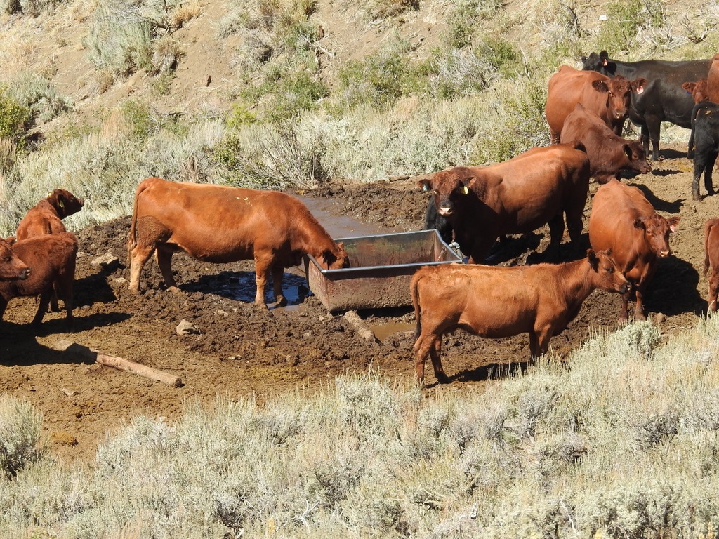
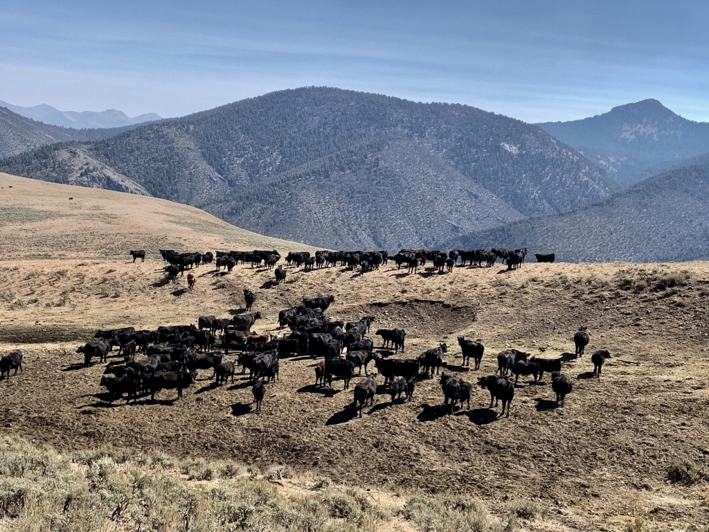
Slashing and burning to ensure cattle have unencumbered access to every inch of the thin green line – fish and amphibians be damned.

A combo jackpot and broadcast burn. Many trees were felled years in advance to get largely fire-resistant sites to burn. Boulder split by fire. Photos from BLM prescribed fire that used Forest EA burn methods.
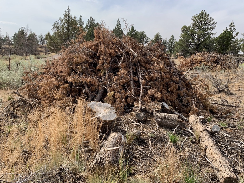
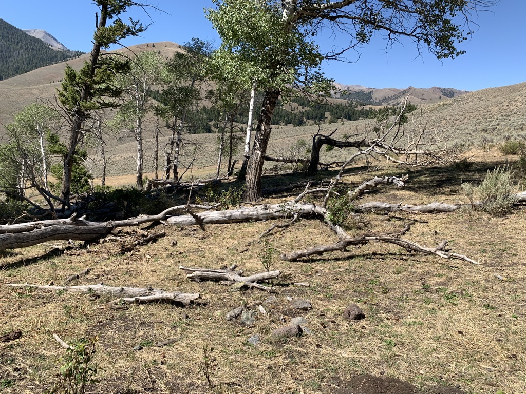
Piles awaiting burning: Trees are cut, slashed, heaped, dried for 2-3 years, then torched scalding soils, scorching neighboring trees and shrubs, and fostering weeds.
Loopholes for Everything
The EAs really don’t conduct analysis. There aren’t alternatives, only No Action where catastrophic fire is our fate. Circular reasoning justifies a single course of action. There’s no baseline data on how limited and fragmented wildlife habitats already are; the precarious status of rare species populations; the location of old growth; or how trashed watersheds are by high amounts of livestock grazing. And not a speck of data on how much carbon will be released or sequestration ability lost.
The Forest Service plans for year-round burning, claiming long lists of “Design Elements” filled with loopholes, will protect everything. As with Zinke’s Outcome-Based grazing that BLM head Stone-Manning has been praising, the plan is that there is no actual plan, and no accountability. The public is to place blind trust in the Forest Service, leaving it free to carry out major fire manipulation projects wherever and whenever the agency wants for decades.
Condition-Based Management: Bureaucratic Arrogance and Laziness Serving Industry
These Fire EAs use Condition-Based Management (CBM), the agency’s most recent artifice. Hubristic managers use CBM to shirk the work of a site-specific NEPA analysis of environmental impacts:
“ In practice … CBM operates to circumvent the National Environmental Policy Act (NEPA) review framework by postponing site-specific analysis until the Forest Service implements the project, which effectively excludes the public from site-specific decisions, reduces transparency, and removes incentives for the agency to avoid harming localized resources. The practice should be curtailed by the Biden administration”.
What the Forest Service is most trying to snuff out is the public’s ability to influence the outcome of major projects. The Biden Forest Service, and its ever-expanding treatment-industrial complex, wants to be free to log or burn whatever it wants whenever it wants. CBM originated in the Obama years. A Trump Tongass Forest CBM logging EIS project was successfully challenged by Earthjustice and others. Most Region 4 Fire projects were scoped in late 2020. But like so much else activists are dealing with, the USDA under Vilsack has wholeheartedly embraced and is ramping up deforestation of all types, stoking the climate crisis. Boastful 30 x 30 talk is cover for relentless federally authorized destruction of our public forests or used to promote tawdry wilderness bills.
Despite these projects causing loss of complex habitat structure for centuries, Sawtooth and Manti documents identically opine that“migratory birds are agile species and are generally able to move away from disturbances and find adjacent habitat areas when displaced”. Entire species might end up crossing the rainbow bridge if this twisted management mentality continues. Dog people know what this means. A Humboldt-Toiyabe EA analysis table proclaims for species after species that “no loss or fragmentation of habitat” will take place, since everything will be protected by the loopholed Design Elements.
The Salmon-Challis Forest recently held an on-line session to sell its Fire EA to a collaborative group. Someone asked how the Forest could sign a FONSI (document stating there would be no significant impacts) and slide by without an EIS. The fire planner, who had been touting “good fire, good fire”, delusionally replied: “Fire doesn’t really have impacts”. Then she caught herself, and said “It has lower impacts, it’s not like a road”. Just ignore the “pre-treatment” chain-sawed stumps, crazed jackpot and pile burning, aerial napalming of fire-resistant old growth sites, forage seeding to replace sage, cheatgrass, linked logging and rare species habitats lost for centuries?
Across the Intermountain Region, including the ever-hotter and intensively grazed
Salmon-Challis, cheatgrass’s irreversible grip is expanding. Burning will permanently eliminate habitats if cheatgrass takes root post-fire. Any recovery of aspen is increasingly uncertain under climate stress and constant pommeling by livestock. Researchers warn cheatgrass may prevent mountain tree recovery.
Timber-driven Region 4 Forests are using CBM for logging. A prime example is the Boise Forest Sagehen project. There, burning of the Snowbanks Roadless area and up to 45,000 acres of fire use was folded into a major logging project. WildLands Defense, Alliance for the Wild Rockies, Native Ecosystems Council and Yellowstone to Uintas Connection have challenged the Sagehen project and are commenting on and filing Objections to many of these Fire EAs.

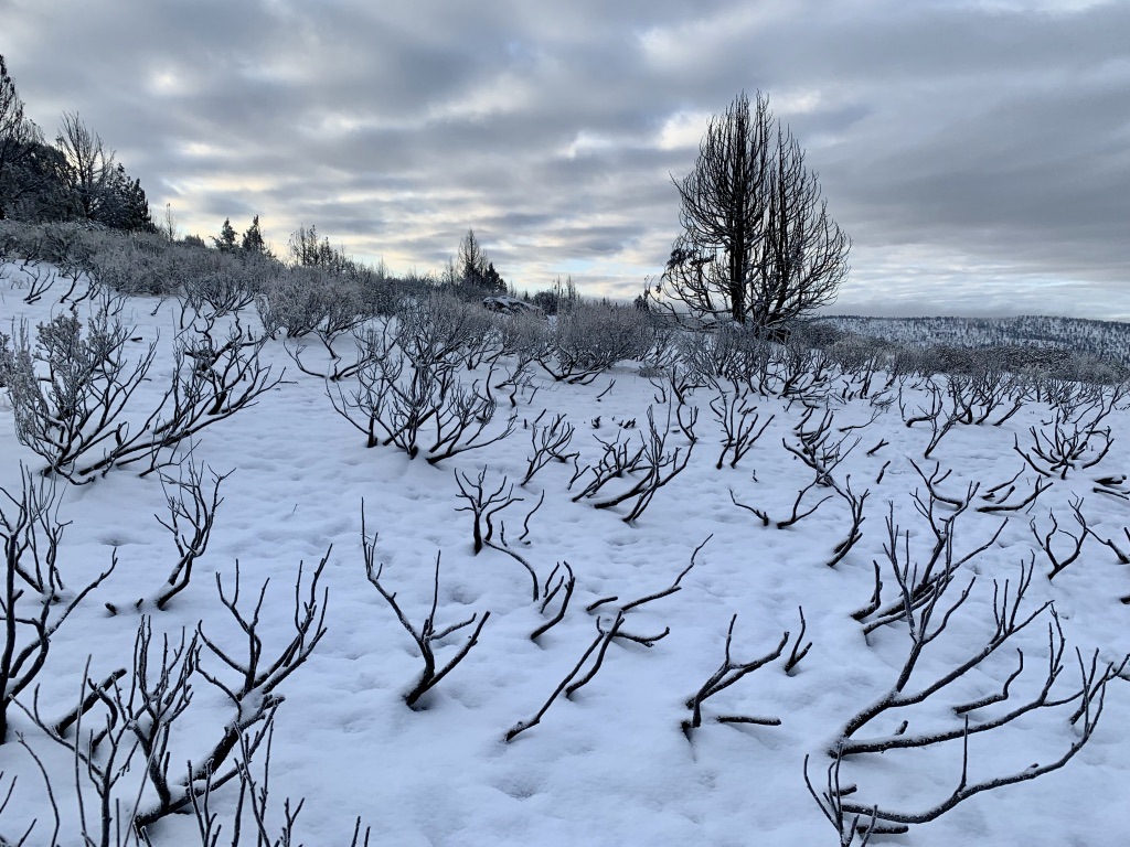
Some of the EAs pretend the agency can “underburn” sagebrush. Underburned sage = dead sage.

Region 4 Forests already have dense mats of cheatgrass from past sage destruction and PJ deforestation projects, wildfires, and cows – exposing the foolhardiness of now using greatly increased burning (which cheatgrass loves). Humboldt-Toiyabe southern Ruby Mountains.
No place can be left unmanipulated. High elevation ridgetop burns of whitebark and limber pine are slated. The likely outcome will be killing off remnant younger trees.
Pyrosilviculture: Prescribed Fire in the Service of the Logging Industry
There’s more to this burning scheme than is openly articulated in the EAs. At the Salmon-Challis session, the fire planner first fearmongered over catastrophic fires of 500,000 acres in the Frank Church Wilderness a decade ago. These were extreme weather-driven fires. She quickly segued to saying not nearly enough land has been burning, that 70,000 acres a year needs to burn (to fit the models) and spoke of using “pyrosilviculture”. The agency keeps this term out of the Fire EAs.
A commentor worried that “Pyrosilviculture is swapping chainsaws for drip torches”. The planner allayed his fears. She replied that after a burn, she “would go to the timber shop and ask what’s viable and reasonable to log”. The Forest would then do NEPA on post-prescribed burn logging. There’s a smorgasbord of minimal NEPA review Categorical Exclusions at the agency’s disposal. Burned trees are an inherent hazard and might fall over. Windthrow’s a problem if they do topple, and its agency gospel that dead wood must be cleared off and hauled away for industry profit.
How neat and tidy. The EAs admit to pre-burn logging designs “pre-treatment using ground-based timber harvesting” authorized under separate NEPA. Now we learn that pyrosilviculture (a new term to me) is also to prime the forests and Roadless Areas for post-burn timber exploitation too.
A 2021 Forestry Journal article by North et al. touts pyrosilviculture for industry profit: “Recommendations include leveraging wildfire’s “treatment” in areas burned at low and moderate severity with subsequent pyrosilviculture management, identifying managed wildfire zones, and facilitating and financing prescribed fire with “anchor,” “ecosystem asset,” and “revenue” focused thinning treatments”. This all “would restore dry forest resilience”, and “overcome treatment inertia”. Read it at your peril.
Now in 2022,“a new study, by Malcolm North and others (2022), promotes the idea of killing and removing 80% of the trees in the forests of the Sierra Nevada through commercial logging, ostensibly as a wildfire management strategy. The North study was authored by scientists funded by the U.S. Forest Service …”. John Muir Project’s Chad Hanson exposed how this latest North paper omitted key historical tree density and other data.
The Salmon-Challis Fire EA aims to burn 10,000 acres a year. But in addition, this Forest has separately authorized a 112,000 acre mega-burn South Lost River Range CX project with 92,000 Roadless acres, asserting “timber stands would be restored” and a similar 71,000 acre Big Creek project with 68,000 Lemhi Roadless Acres. The proposed Stormy project combines logging and burning that coincidentally would clear country in a region of booming cobalt exploration. What to do if unsightly stumps impair wildness? The Big Creek documents solve that: “After thinning, the slash is allowed to decay … within 1-4 years after cutting, the stumps are burned”. There’s no problem that can’t be fixed by pumping more carbon into the atmosphere. Agencies claim lands should burn like clockwork at short intervals. Helicopter napalming and drip torch medicine, with a teaser or chaser of logging, will bend the land to fit the models. And yes, the Forest Service can connive to log in many Idaho Roadless Areas.
The Salmon-Challis fire planner also said: “We mimic wildfire and follow up with timber harvest”. I’m not so sure that “ground, vehicle-based, and aerial applications of fire … started using handheld drip-torches, spherical ignition devices applied via aircraft or helicopter, fusees, flares or fire launchers, or propane torches”, and pile burning, jackpot burning, chainsawing and manically purging downed wood or logging burned trees will mimic anything “natural”. Nor will it resemble the indigenous burning practiced in some landscapes that she had tried to cloak Salmon-Challis projects in with her talk of “good fire”.
Remember how “good fire” was hyped in the headlines last summer as a panacea when big California wildfires burned? How much of that was to pave the way for, and greenwash, the Forest Service and logging companies pivoting to embrace industrial scale prescribed fire use to open more lands for timber extraction?
Condition-Based Fire Forever, Endless Forest Extraction, Biodiversity Loss
With these vague EAs, you can’t pin the agency down on anything. There’s no concrete project, no data, no site-specific analysis. The door is slammed on the public as the projects are carried out over decades. The Manti-La Sal Silvicultural Report shows 32 years of treatment. The Salmon-Challis plans for “many years”. Western forests also now face the Lawless Logging folded into the Biden Infrastructure Bill, and newly minted firesheds where trees will be liquidated.
With year-round prescribed fire use, there’s no possible way that burning won’t destroy many bird nests, eggs and nestlings. Small mammals, reptiles and native pollinators will be lost too. The agency can wiggle out of weak mitigation measures. We won’t burn up the nest tree when the hawk is incubating (unless we roll the biologist into saying we can). Wording appears crafted to allow destruction of many species nesting territories outside the nesting season. Good luck to any biologist who attempts to push back against aggressive fire staff plans. Bird death avoidance measures keep getting worse with each new Forest or BLM manipulation proposal. The Haaland Fish and Wildlife Service is miserably failing to protect migratory birds facing agency manipulation projects. But Interior finds time to keep on persecuting a whistleblower who spoke out in defense of migratory birds on a Trump drilling project. The EAs will play out on top of unpredictable wildfires, and a multitude of other deforestation projects. It sickens me to think of the plight of migratory birds – faced with megadrought, grazing impacts and development that will now face even more long-term nesting losses, and destruction of food plants essential to survive migration.
Few Region 4 allotments have undergone grazing analysis in recent decades, so there’s no data on how degraded they are.

Vast areas of Aspen are to be burned. The Forest Service is in denial of the severe impacts that overstocked livestock herds are having on Aspen across the region. Uncontrolled cattle browsing prevents regrowth.
Wonder why the Salmon-Challis wants to burn much of the Lost River Range?
Region 4 Forests Are Major Grazing Forests and Cows Drive Management
Fire has long been used to prop up the livestock industry on depleted western public lands. Before the Forest Service’s inception, sheepherders and cattlemen were lighting fires to get grass. Young and Clements in Cheatgrass Fire and Forage on the Range cite Pickford and other sources:
“… widespread promiscuous burning was one of the major factors in the spread of cheatgrass in former sagebrush bunchgrass …”.
“Sheepherders were not the only ones setting fires for forage management. James A Young’s father told him that cowboys bringing cows down from the Salmon mountains for winter burned everything behind them”.
Vast deforestation accompanied the 1800s mining booms in the Intermountain West. Humboldt-Toiyabe country was ground zero, but all Intermountain Forests suffered mining and settlement clearing. The Forest Service and BLM burned, sprayed and chained for forage production across the West in the 1950s-1970s. Non-stop logging continues leveling what’s left of older forests. Now endless fuels projects have further impoverished forests, leaving them hotter, drier, windier, and more likely to burn. The LANDFIRE models are designed first and foremost to continue Settler domination of Intermountain ecosystems. This is what agencies and NGOs are embracing, as they wail about fire suppression to champion efforts to drastically manipulate, simplify and fireproof forests. The Salmon-Challis planner talking of “good fire” sure seems to me to be a form of cultural appropriation for the sake of forest exploitation.
The Humboldt-Toiyabe permits a quarter million cattle and sheep Head Months/AUMs annually. The Manti-La Sal permits 144,000. Utah forests are often awash with exotic grass seedings where native sage and trees were destroyed for cow food. Underneath endless talk of “departure”, these are livestock forage projects. The 1980s Manti-La Sal Forest Plan (still in place) identifies burned aspen regeneration as forage. The Manti Fire EA fleshes out post-burn seeding on land with slopes less than 20%, which means tractor drill seeding is intended, and states “additional impacts may include concentrated livestock grazing within seeded areas”. The Ashley project openly includes non-native seeding. This sure sounds like burning to please the Cattlemen’s Association. It’s naïve to think this won’t happen under current leadership.
The EAs don’t really explain how to deal with weeds. Will a sudden need for “targeted grazing” arise? The Humboldt-Toiyabe is already going there. In its appalling 2021 eastern Sierra Marine Warfare site decision, the Bridgeport District authorized prescribed fire, cutting, mastication – and when project-generated cheatgrass takes over, “fine fuels grazing”:
“Occurrences of invasive or noxious grasses … cheatgrass … and medusahead … may be targeted for grazing to reduce fuel loading and seed head production”.
High amounts of permitted sheep grazing already mar this beautiful eastern Sierra area where the Marines gained authorization for scattered landing sites for gawky V-22s prone to hot underbellies that could ignite surrounding vegetation. LANDFIRE models conveniently found 18,000+ acres were “departed” and must be thinned and/or burned, with more grazing to futilely deal with flammable grasses.
Bridgeport Marine War deforestation landscape – it won’t look like this for long.
Severe regularly permitted sheep grazing impacts in the Marine Warfare project area – sheep kill sagebrush, and strip aspen and bittercherry. Herds were run right through recent pile burned areas from another forest manicuring project already underway here.
Contradictions Abound: Insect-killed Dead Trees Bad, Project-Killed Dead Trees Good
Right before the Humboldt-Toiyabe released its Fire EA, it scoped a separate Deer Mountain project across 40,000 acres of Jarbidge Bull Trout watersheds. That document lamented insect-killed trees, ignoring that past fuels projects may have lured in insects and stressed trees surrounding the now hotter drier sites. The Forest claims this new project is needed to “reduce heavy fuel loading” from insect killed trees. Rationales are twisted for the project at hand. Undeterred by real-world observations of how climate-driven big fires are burning, the Forest Service uses its voodoo vegetation models to claim it can conquer the fire frontier. Federal agency focus on incessant manipulation of wild lands will only further endanger wildlife, watersheds and communities communities.
Glistening cheatgrass seedheads in treatment-mauled Pinyon-Juniper forest on the Humboldt-Toiyabe Bridgeport District. Trees were variously cut, piled, burned, or bulldozed over.
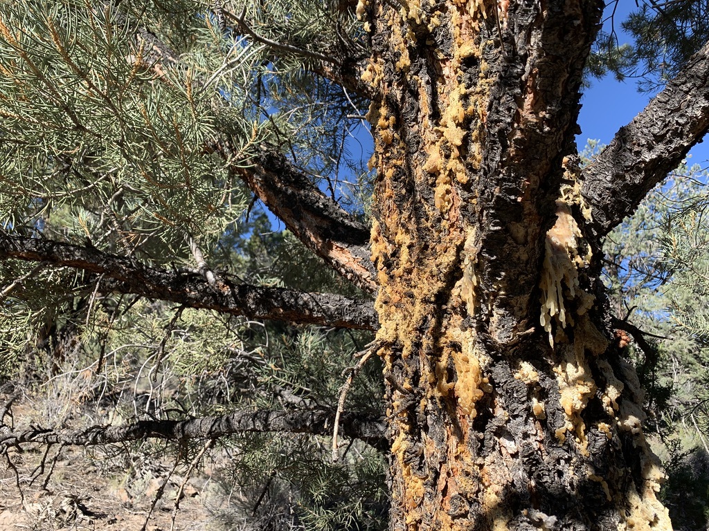
An old growth Pinyon Pine oozing pitch, fighting to survive insects drawn in to cut branches and neighboring wounded trees in a Forest PJ destruction zone, Humboldt-Toiyabe Bridgeport District.
What will be the future of Intermountain forests and wildlife if today’s federal agency manipulation and exploitation madness continues?